Nature
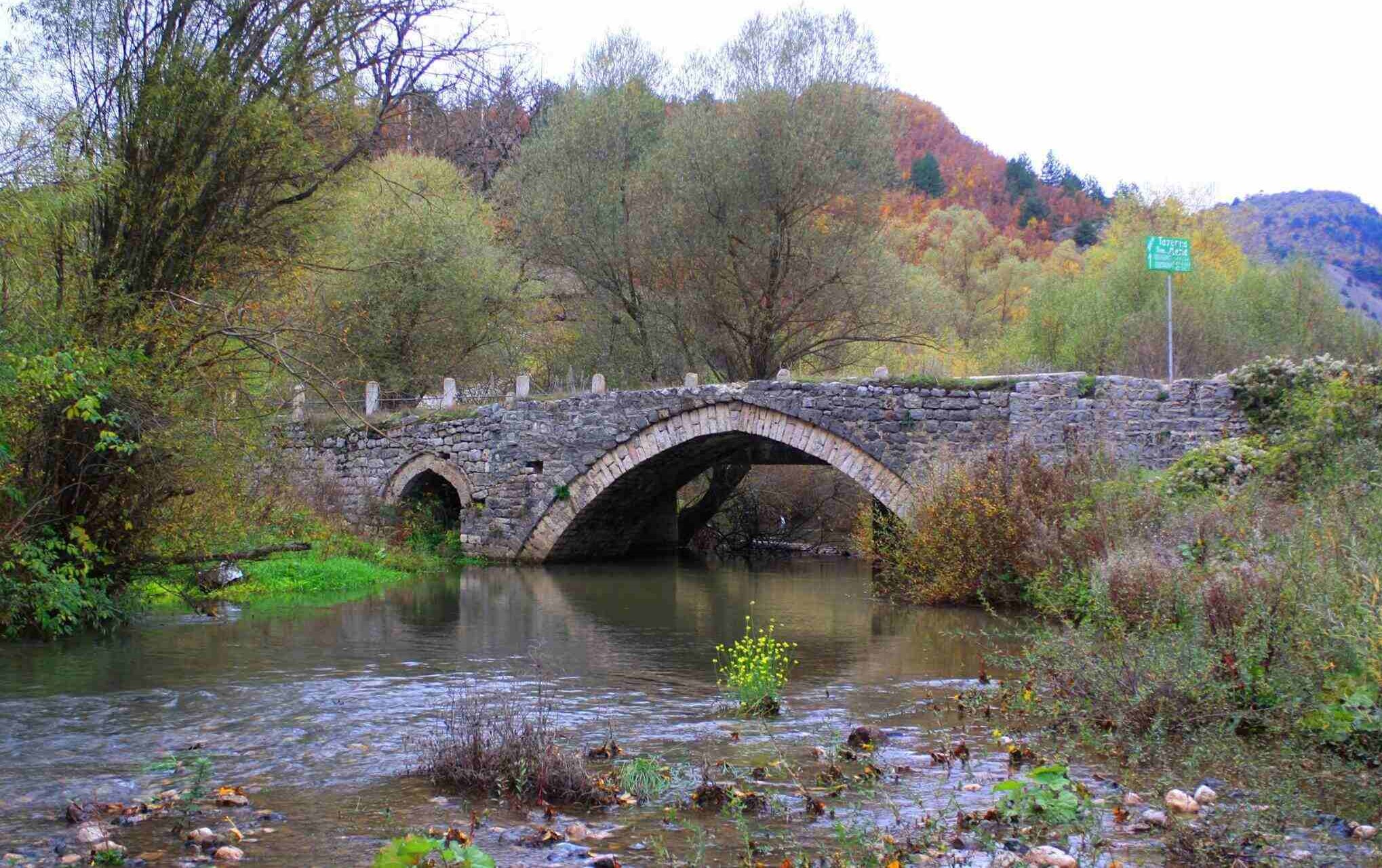
Zoto's Bridge, Vithkuq
Zoto's Bridge is located at the entrance to Vithkuqi, about 300 m away from it. The bridge is a cultural heritage monument, of the "Architecture" type, approved in November 1984. Its typology is a bridge, built in the XIX century. It is 30 m long, 3 m wide and has a vault approximately 3 m high. While inside it there is a small vault, with a height of about 2 m and a length of 1.4 m. The Bridge of
.webp)
Nature
Kamenica Tumulus
Kamenica Tumulus is a prehistoric settlement. The tumulus is a monument of cultural heritage in Korça, type "Archaeology", approved in September 2008. It is one of the largest tumulus in relation to the other 200 excavated mounds in Albania and other neighboring areas of the Balkans and beyond. The central grave with which the construction of this tumulus begins, belongs to a dead man in hi
Nature
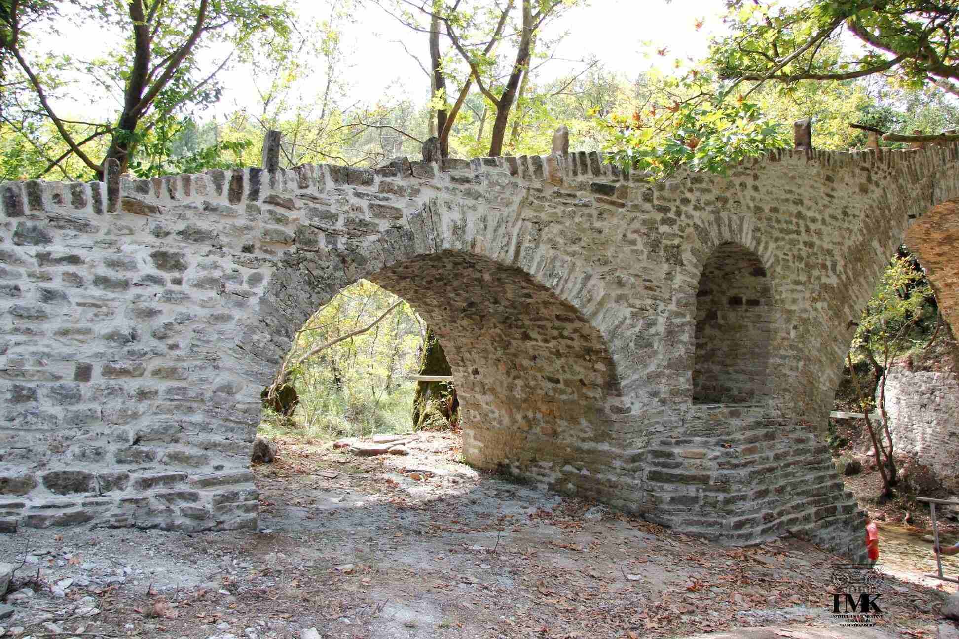
Nivan Bridge, Zagori
Nivan Bridge or Zagoria Bridge is a cultural heritage monument in Nivan - Zagori, Gjirokastra. This monument was approved in June 1973. Its typology is a bridge, built around the 18th century.
The bridge was built over the Zagoria river, between Gjirokastra and Përmet. It is composed of two arches: the main arch above the river and a smaller arch, above ground, at one of the legs of the brid

Nature
Zhej's Rock, Libohova
The rock is located near the village of Zhej, at an altitude of 1,300 m above sea level. The rock represents a large olistolith of calcareous composition, placed in a mass of more clayey flysch.
Zhej's Rock is 200 m long, 100 m wide and 500 m high.
Various birds such as wild pigeons, hawks and eagles have nested on the steep slopes of the rock. It has scientific, didactic, cultural, ecological a
Nature
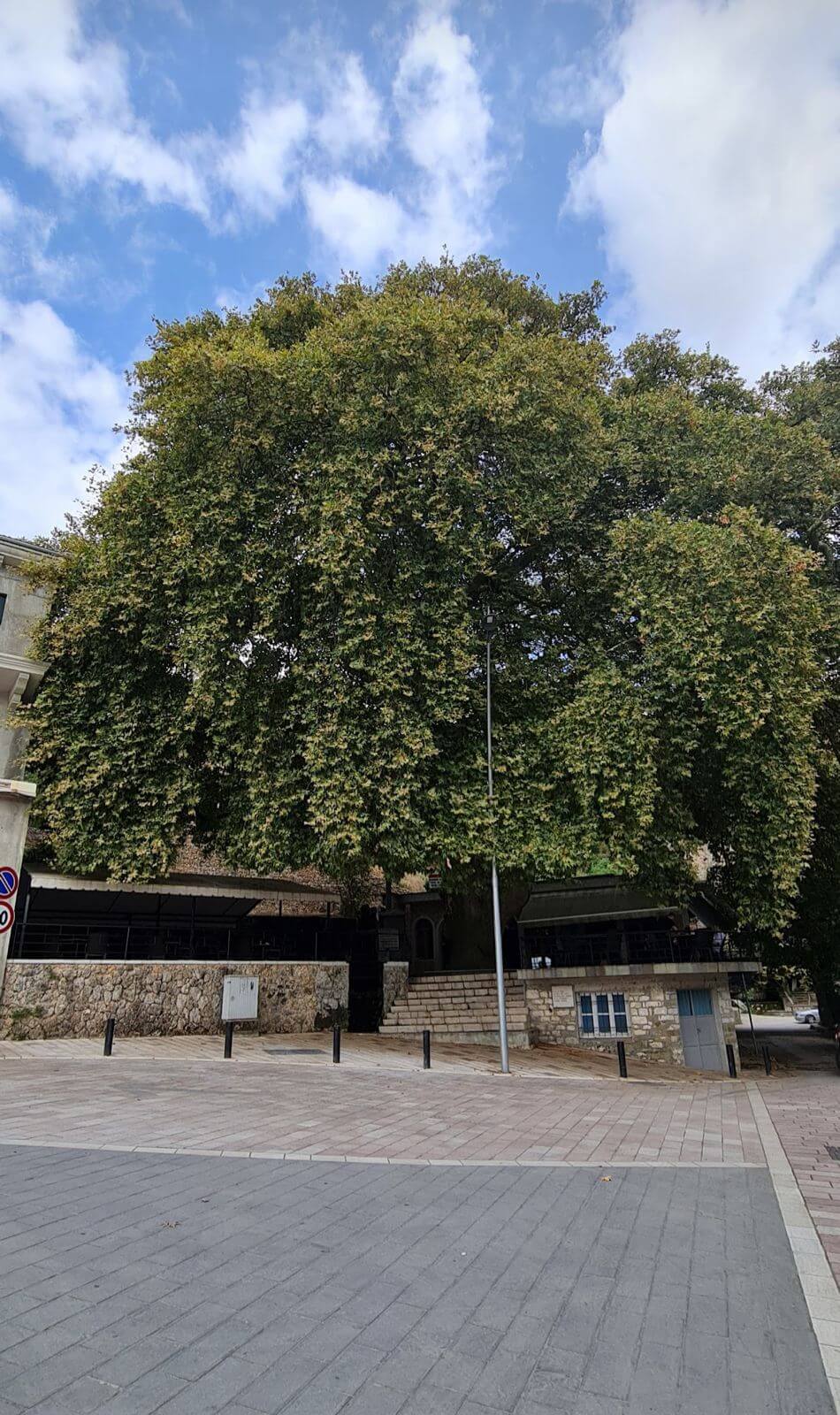
Libohova Plane Tree, Gjirokastër
Libohova Plane Tree is a log, a plane tree located in the center of the city. The plane tree is 220 years old, with a height of 32 m, a trunk diameter of 220 cm, a trunk circumference of 692 cm, and a crown circumference of 80 m.
The plane tree has been declared a natural monument, with scientific, historical and touristic values. It is still preserved in very good condition. The water source und
Nature
Subash Bridge over the Drino River, Gjirokastër
Subashi Bridge is located about 200 m away from Gjirokastra Street. The bridge is a monument of cultural heritage in Subash, of the type "Architecture", approved in May 1991. Its typology is a bridge, built in 1830.
It is mentioned as early as 1830 by Hujks, who says that: at 11 miles from Gjirokastra and Tepelena, the Drino plain narrows into a gorge, where near a good inn there is a magnificent

Nature
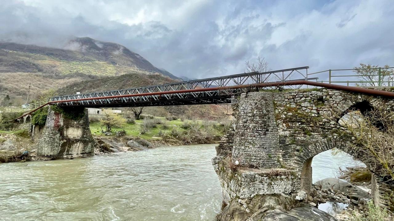
Kollorca Bridge, Gjirokastër
Kollorca Bridge is located 4 km south of Gjirokastra. It is the grandest bridge of Dropulli, with a length of 103 m and crosses the Drino river with five arches. The bridge is a monument of cultural heritage, type "Architecture", approved in June 1973. Its typology is a bridge, with stone arches.
The bridge is 3.70 m wide and approximately 7 m above the water level. The arches rest on four simila
Nature
Roman Cistern
The Roman cistern is located about 30 m north of the entrance gate of the Onhezm castle. At that time, it was built in the backyard of the archaeologist A. Nanaj.
Its traces and structure have been fully preserved, conserved with great effort, on the ground floor of the hotel built on it in later years.

Nature
Plaques Beach, Saranda
The plaques on Saranda beach are a natural monument, approved in 2002, part of the historical memory of the residents of Saranda, but also of the thousands of vacationers who have visited the beach in this country.
It is said that the workers from Czechoslovakia, who were part of the work team for the opening of the Čuka canal, also made the beach on Plaques beach in Saranda.
Currently, the ter
Nature
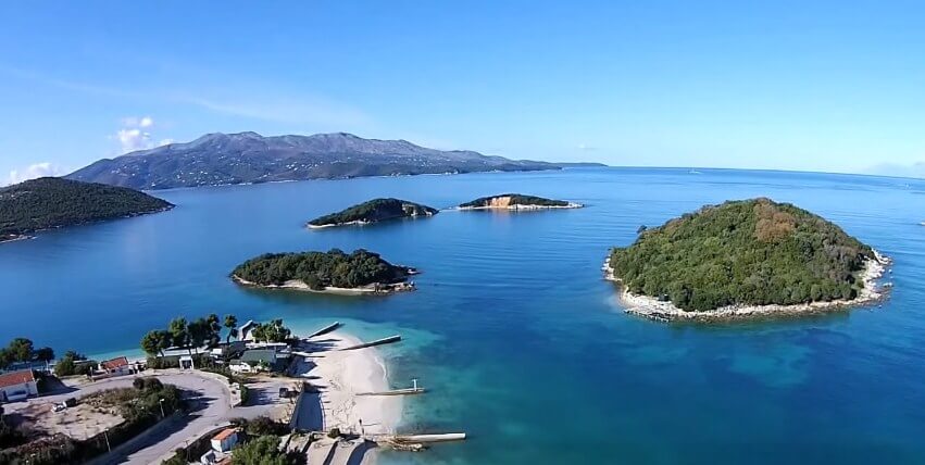
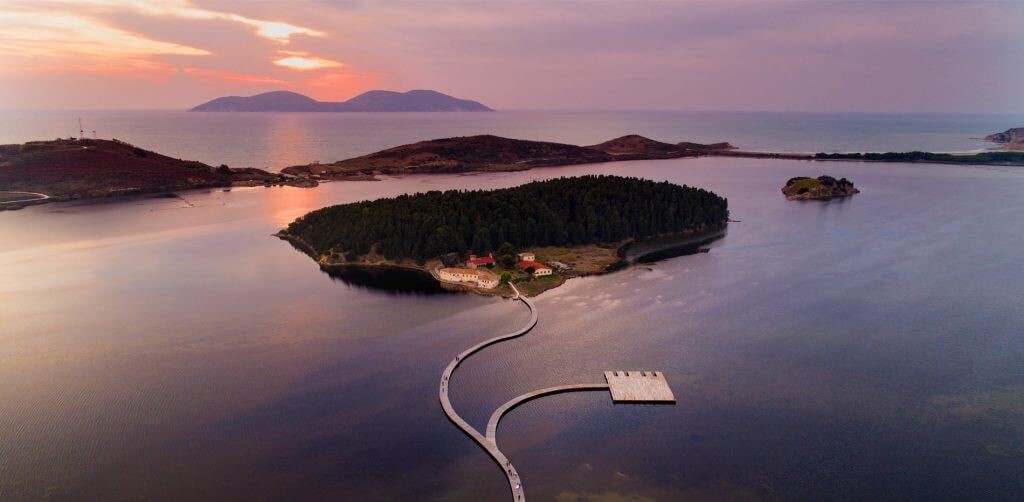
Ksamil Islands
Ksamil Islands or Tetranis Islands are four small islands located 8 km south of Saranda. Ksamil Islands are the most attractive part of this coastal area.The combined area of the four islands of Ksamil is 7.1 ha and they are part of Butrint National Park.
The islands can be reached by boat. All four islands are named after the village where they are located, Ksamil, which is located in the
Nature
Finiq City
The city of Finiq is located 7 km from the city of Delvina, 8 km from the shores of the Ionian Sea and 20 km from the city of Saranda. The total area is 44,100 ha and the population reaches 35,518. Finiqi borders Delvina to the north, Dropulli to the east, Greece to the south and Saranda to the west.
The city has an ancient history, as the capital of the Kaons, while in the 3rd century it b
Nature
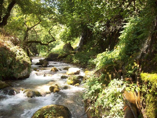
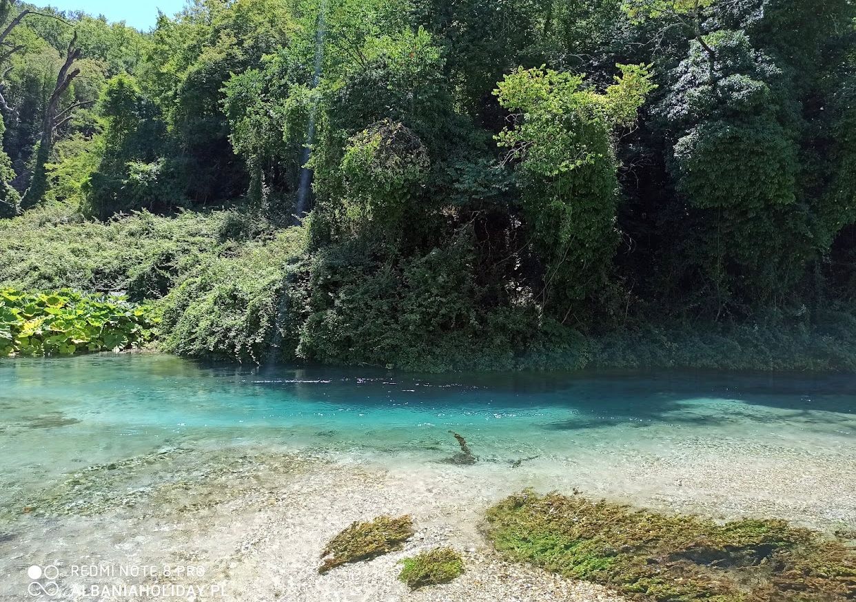
Kalasa River
The Kalasa River originates in the south of the Galishti mountain and follows the direction from the southeast. Under Tatzat, it collects large karst sources and after receiving the waters of the Delvina and Gajdar streams, it crosses the Vurgu plain.
The Kalasa River is the largest tributary of Bistrica in the northeast of Saranda. It has a length of about 34 km, an average height of 531 m and a
.jpg)
Nature
Pavlla River
The Pavlla River originates near the village of Pavlla in Çamëria, in the southernmost part of Albania. The river flows in a sheltered bed through the plains of Mursia and Vrina, passes south of Lake Butrint and flows into the Ionian Sea, in the Gulf of Butrint.
The river is 50 km long, with an average height of 521 m and a catchment area of 374 km². The Karroqi stream is also th
Nature
Bistrica River
Bistrica River originates from the Gjerë mountain and takes its direction in the southwest of Albania. Bistrica is the only river in Albania that does not flow into the Adriatic Sea, but into the Ionian Sea. The name Bistrica comes from the Slavic language bistro, clear.
The Bistrica River initially emptied into Butrint Lake, connected by the Vivar Canal to the Ionian Sea. Bistrica is

Nature
Nivica Canyons
Nivicë canyons are located near the village of Nivicë, in the south of Albania. The canyons were formed by the erosion of the Nivica stream, part of the Benca river, in carbonate rocks. It is several km long, 15 m wide and up to 700 m deep.
The stream of Nivica has formed a gorge with a very narrow bed, about 3 km long, it continues with the basin in Merje and joins the Gurrë e Pro

Nature
Leshnica Bridge
Leshnica Bridge is located in Dhivër, Saranda.
The bridge has undergone restoration which consists of its maintenance, consolidation and cleaning. Also, the works were carried out in the masonry by filling the joints, placing gabions, for the protection of the shoulders of the bridge from the current of the river, as well as the restoration of the cobblestones of the bridge.
Nature
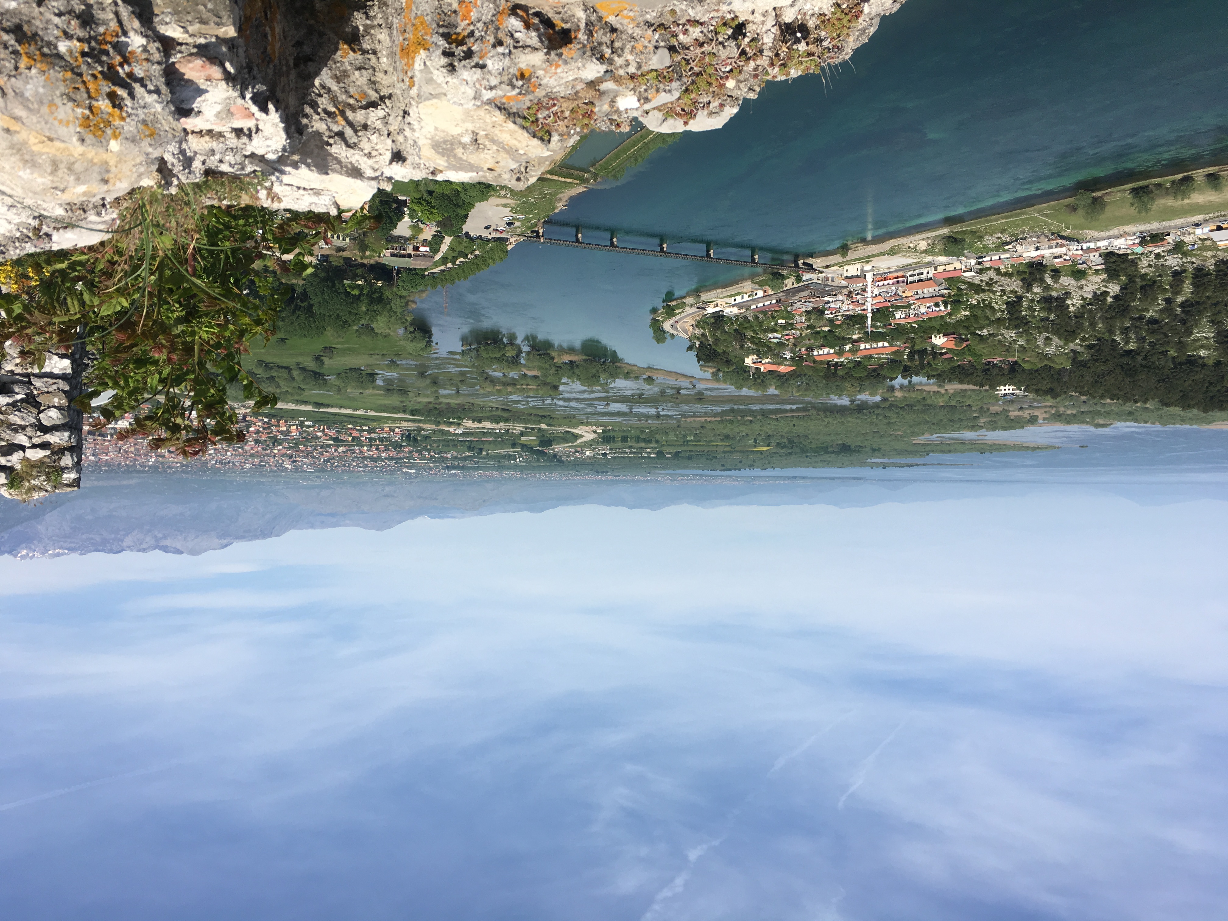
Buna River
The Buna River, originating from Lake Shkodra, winds its way for 44 kilometers before meeting the Adriatic Sea, serving as the natural border between Albania and Montenegro. Along its picturesque journey, it showcases a rich tapestry of flora and fauna, with lush fields and forests lining its banks.
The river's delta, with Ada Island at its center, is a haven for migratory birds and supports dive
Nature
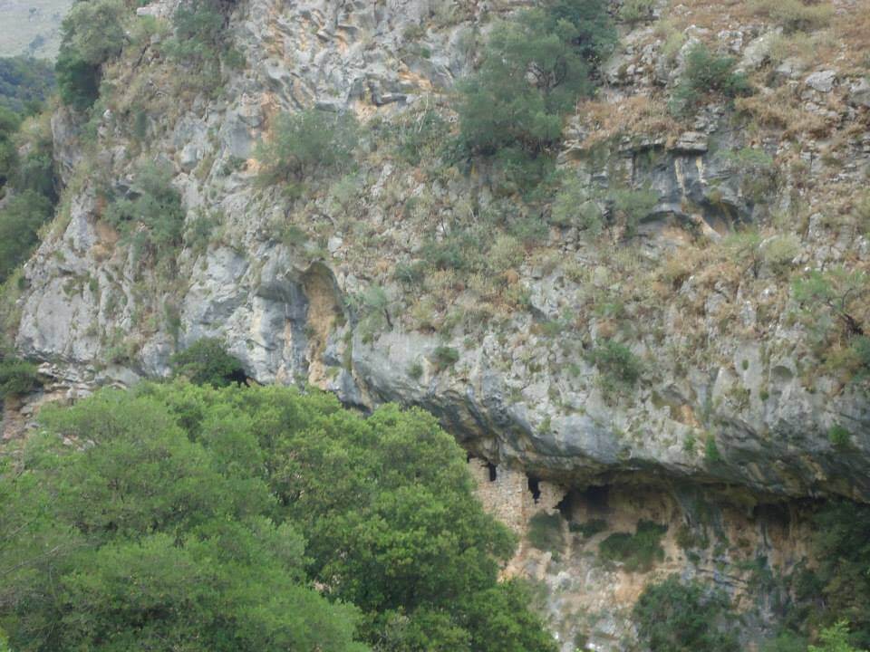
Tatzat Cave
Tatzat Cave is located near Tatzat village. The cave is formed in upper Cretaceous limestone rocks. It is about 150 m long, 5 m wide and 10 m high. It is filled with numerous stalactite and stalagmite concretions of rare beauty.
Tatzati cave has scientific (geological, geomorphological, hydrological, biological), cultural, didactic and touristic values.
Nature
Narta Lagoon
Narta Lagoon is located in the southeastern part of Vlore Bay. It was formed by the continuous accumulation of solid streams of the Vjosa River.It is surrounded by the hills of Zvernec and to the south is Narta. The water salinity is high, ranging from 28 per mil in winter to 75 per mil in summer. The total area of the lagoon is about 42 km², of which 14 km² mainly in the north is
Nature
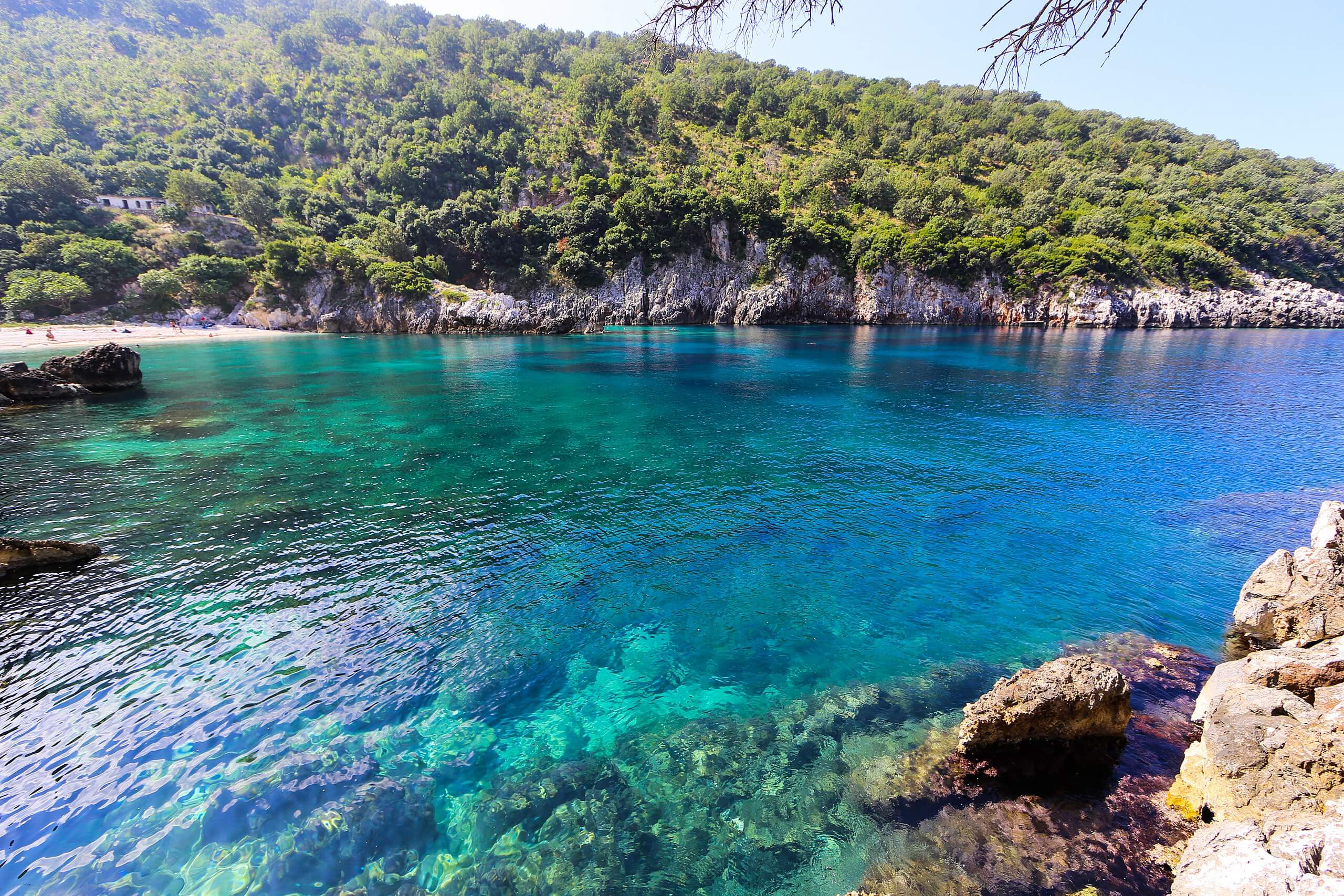
Brisan Bay, Karaburun
Brisan Bay is located on the Karaburun peninsula on the island of Vlore. Brisan Bay, also known as Bear Bay, is a natural wonder. Picturesque landscapes, seaside rocks, typical white sandy beaches and water so clear you can see everything beyond are just some of the special features.
This small bay is still one of Karaburun's loneliest beaches, so it is only visited by vacationers who
