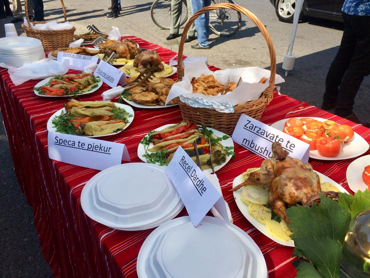
Nature
Postriba village, Shkodër
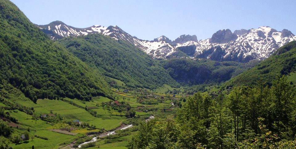
Postriba village is located 6.5 km from the center of Shkodra. Postriba is an ethnographic region that includes the villages at the foot of the Maranaj and Cukal mountains, on both sides of the Kir River, going north to near Sheu t Rrjolli. Agriculture and livestock have been the basis of the economy of Postriba, which continue to occupy the largest part of the economic activity of the area. They
 (1) (1) (1) (1) (1) (1) (1) (1) (1) (1) (1) (1) (1) (1) (1) (1) (1) (1) (1) (1) (1) (1) (1) (1) (1) (1) (1) (1).jpg)
Nature
Ruins of the Church of Shirgji, Shirq
The ruins of the Church of Shirgj are located in the village of the same name, in Shirgj, in the east of Albania. The ruins of the Church are a ruined monastery of the former Benedictine monastery. The church was built by the Serbian queen Helen of Anjou in 1290 and dedicated to Saint Sergius and Saint Bacchus. Inside the church there is a pillar made of black granite, a material that comes from S
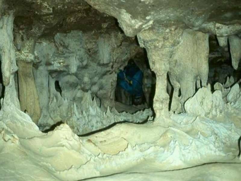
Nature
Kataract Cave, Theth
Kataract Cave is located near the village of Theth, 870 m above sea level. The cave is also known differently as: Grunas Waterfall, Where the water breaks your neck and Water Cave. It is a limestone karst cave, 170 m long, with galleries, wells, expansions and narrowings, water siphons. To visit the Kataract Cave, follow the Koplik-Theth road.

Nature
Cave of Theth, Theth
The cave of Theth is located near the village of Theth, has a height of 900 m above sea level, and a length of over 150 m, with constrictions and expansions, branches, wells and attractive microforms.
The Theth Cave is a well-known and beautiful natural destination located in the village of Theth, a part of the Bread of the Alps in Albania. This cave is a special attraction for tourists and explo
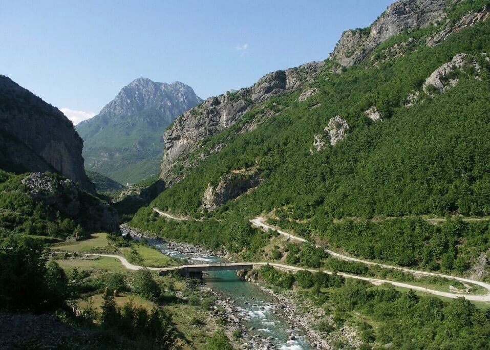
Nature
Portat e Shalës(Shala gates), Shkodër
Portat e Shalës is located in the village of Breglum, in Shala. It represents a river mouth in the form of a canyon, formed by the Shala river in Paleozoic limestone. The gate is 50 m long, 20-25 m wide and over 200 m deep.
To visit Shala Gate, follow the rural road Shkodër-Theth-Breg Lumi.
.jpg)
Nature
Gajtan Cave, Shkodër
The Gajtan Cave is located near the village of Gajtan, about 12 km east of Shkodra. The cave is formed by karst in the Triassic-Jurassic limestones and starts with a karst well. Next to it is a fortified Illyrian settlement of the Iron Age.
It is thought that: the cave is old around 100 thousand years before our era, in the Mesolithic and Paleolithic times, that is, the Old Stone and the Middle S
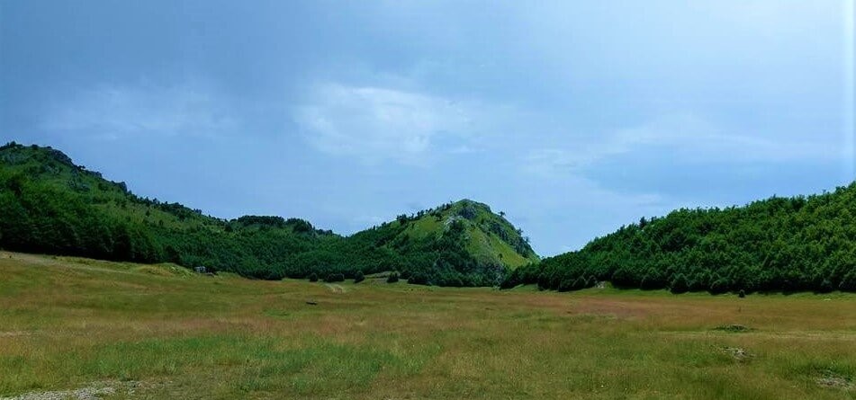
Nature
Liqeth Field, Shkodër
The field of Liqeth is located on the mountain of Cukali, near the village of Lekgegaj. The field is at an altitude of 1200 m above sea level, in Shllak.
It is a glacio-karst pit at the intersection of tectonic detachments. It is 1.3 km long, 800-100 m wide.
There are some small karst formations, cairns, herbaceous vegetation and a small lake during the snow melt. To visit Fushë e Liqethi,
Nature
Sources of Kirit, Pult
The sources of Kir are located near Kir village, in Pult.
The springs are at an altitude of 400 m above sea level. It is a karstic source of the Voclusian type in the tectonic - lithological limestone - flysch contact.
Its water comes out along a line over 800 m and their flow reaches over 600 l/sec. The sources carry scientific hydrological, didactic and touristic values.
To visit the Sources

Nature
Flag Pine, Qafa e Pejës
The Flag Pine is located in the Peja Pass, 1700 m above sea level.
It is a 220-year-old tree with a crown in the shape of a flag, with a height of 20 m and a trunk diameter of 1.6 m. Flag Pine carries scientific, cultural, didactic and touristic values.
To visit the Flag Pine, follow the rural road Skodër-Theth, on the footpath.
Nature
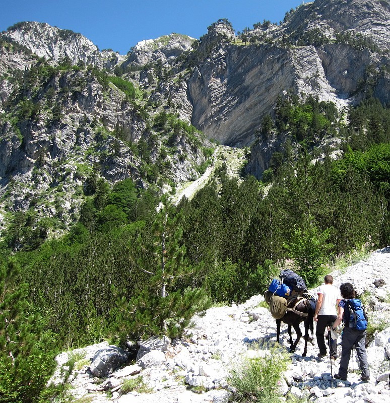
Jezerca Pit, Theth
Jezerca pit is an amazing natural destination in Albania, located near the village of Theth, in Shala. The pit is over 1.5 km long and contains moraine deposits, which are debris left by the movement of glaciers. In addition, there are also 4-5 small glacial lakes, creating a wonderful natural landscape. To reach Gropne Jezerce, follow the road from Koplik in the direction of Theth.
Next, one can
.jpeg)
Nature
Bashkim Canyon
Bashkim Canyon is located near the village of Vermosh in Kelmendi, 900 - 950 m above sea level. It is formed in limestone from the Vermoshit river and karst. The canyon is 1 km long, 4-6 m wide and 30-40 m deep. To visit Bashkimi Canyon, follow the Koplik-Tamarë-Vermosh road.

Nature
Gjolaj Cave, Bratosh
Gjolajve cave is located in Bratosh village. It is a glacio-karst cave formed at the junction of the tectonic fault, in the limestones of the Triassic-Jurassic period. The cave starts with a karst well and is 116 m long, 20-25 m wide and 25-27 m high. There is a very large hall with stalagmites, stalactites, very beautiful columns and geomorphological scientific, didactic and touristic values. To

Nature
Canyon of Përroit te Thatë (Dry Stream)
The canyon of Përroit të Thatë is located near the village of Zagorë, at an altitude of 250 m above sea level. The stream called Përroi i Thatë passes through the municipality of Shkrel, which has a length of 33 km. The stream was named Dry Stream because, despite being located in one of the areas with the most rainfall in Albania, its bed has no water. Due to the pro
Nature
Goat Path Castle, Shkrel
The Goat Trail Castle is located near the village of Bogë, at an altitude of 2050 m above sea level. The castle is a limestone block with a pyramidal shape, modeled by the wind and karst. It is 150-200 m long, 80-100 m wide and 130-150 m high. To visit the Goat Trail Castle, follow the Koplik-Theth rural road.

Nature
Messi Bridge on the Kir River, Shkodër
Mesi Bridge is located 8 km from the city of Shkodra over the river Kir. The bridge is a cultural monument of great value and a symbol of ancient civilization. It served to connect Drishti with Shkodra and was built by Mehmet Pashë Bushati, in 1768. From the construction technique, Mesi Bridge has had two construction phases.
• In the first phase, the central arch was built and 3 others

Nature
The Cave of Arap peak, Theth
The cave of the peak of Arapi is located near the peak of the same name of Harap, near Theth. The cave is at an altitude of 840 m above sea level, in Shale.
It is formed by karst in Triassic-Jurassic limestones and has water wells, siphons and karst microforms.
It is 3 km long, while the width and height are up to 20-30 m.
To visit the Arapi Peak Cave, follow the road Koplik-Theth-Okol-Kroi i S

Nature
Zhyle Cave, Shkodër
Zhyle's cave is located near the village of Prekal in Shkodra, about 400 m above sea level.
It is a karst cave in limestone, 104 m long and with galleries and extensions.
To visit the Zhyle Cave, follow the Shkodër-Prekal road
Nature
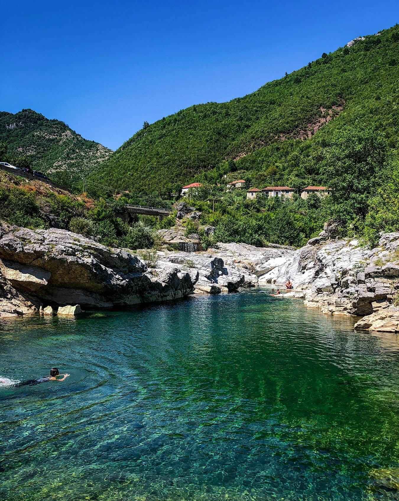
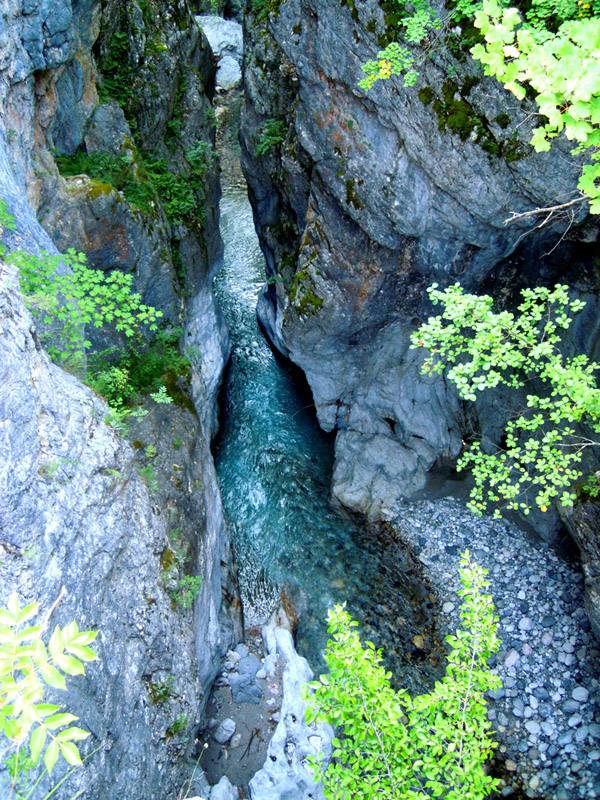
Canyon of the Shtrenjte Bridge, Shkodër
The Shtrenjte Bridge Canyon is located near the village of the same name, in the Shtrenjte bridge. The canyon is 120 m above sea level, in Postriba. It is formed from limestones, from the Kyri River.
It is 700-800 m long, 5-6 m deep and 2-4 m wide. In the same place is the Kiri bridge that connects Shkodra with Prekal. To visit the Strenje Bridge Canyon, follow the Shkodër-Prekal road.
Nature
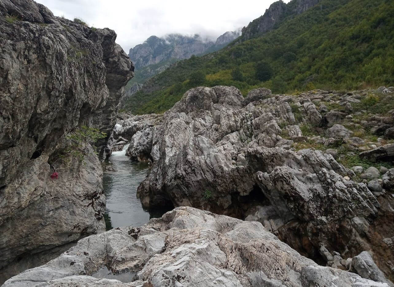
Grunas Canyon, Theth
Grunas canyon is located in the southern part of the Theth village park. The canyon is a natural monument, at the height of 700 m above sea level, in Shale. Formed by the Theth River and by the karst in the limestone rocks, the Canyon is about 1.8 km long, 40-60 m deep and about 4-6 m wide.
The canyon has an incomparable beauty where there is always enough water for canoeing enthusiasts.
The wat
Nature
Xhek Mark's Well, Malësi e Madhe
The well of Xhek Mark is located in the village of Bogë, on the plateau of Bridasha, 1800 m above sea level. It was named after a resident who fell there more than 80 years ago. It consists of a karst well, with a depth of about 234 m. Its entrance has a diameter of 5 m, with a depth that goes up to -15 m, where two wells appear, which go down to a depth of -104 m. Also found: some side branc
