National Parks
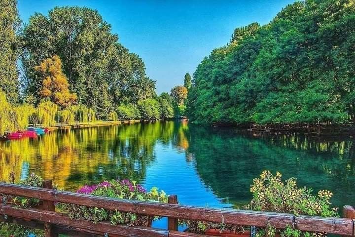
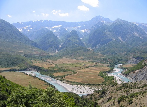
Pogradec City
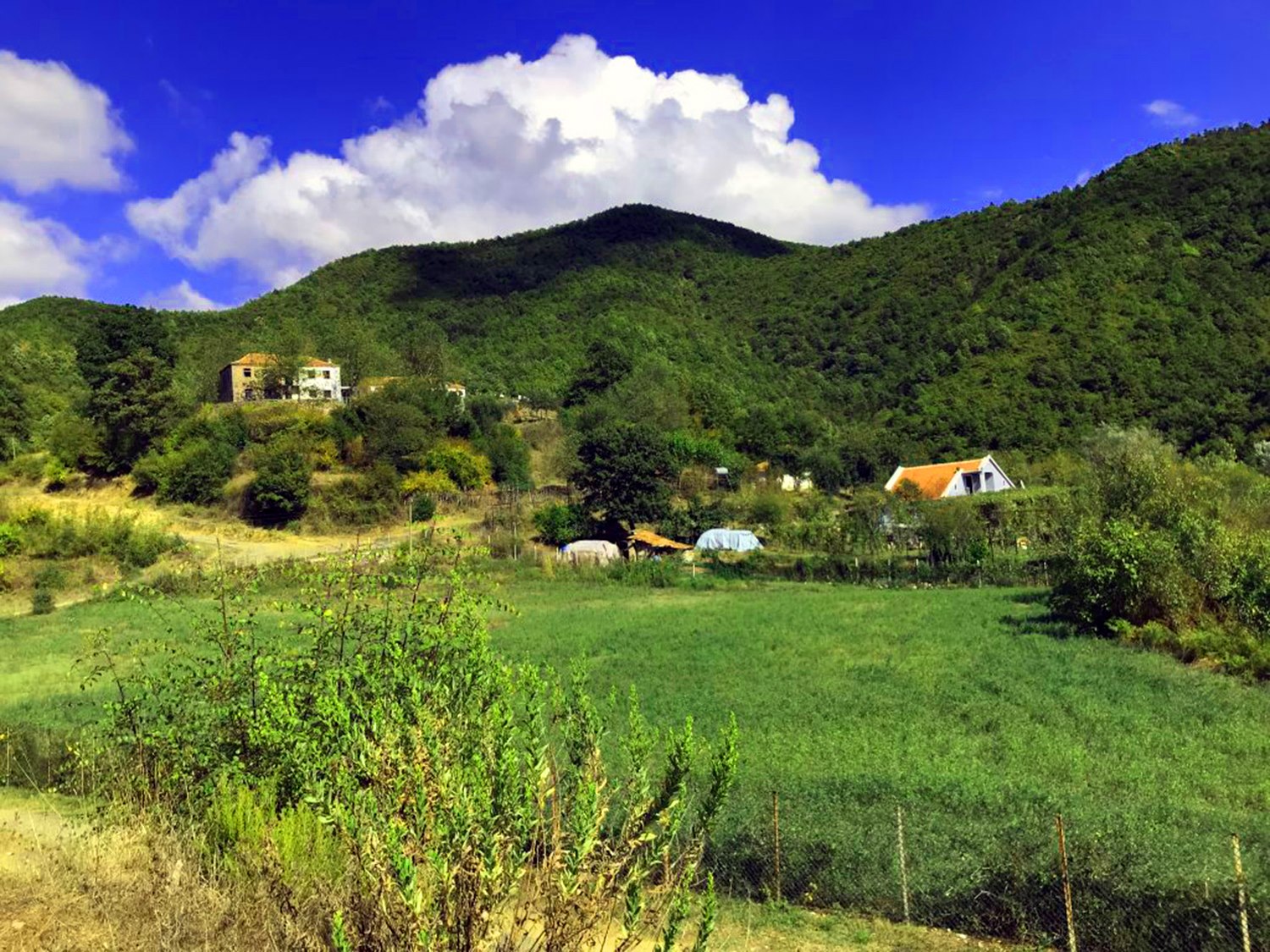
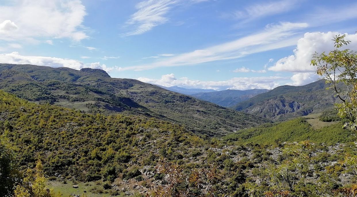
Pogradeci is located about 40 km away from Korça, 5 km away from Tushemishti and 25 km away from Ohrid. The city has an area of about 27,323,00 ha and lies in a valley surrounded by mountains to the west, low hills to the south and east. It is a cross-border mountainous area. It also has the deepest tectonic lake in the Balkans with a depth of 290 m and one of the most important in Europe.P

National Parks
Bogovo Village
The village of Bogova is located to the right of the Osum River and Tomorri Mountain in Berat, at an altitude of 265 m above sea level. Bogova lies exactly at the exit of the Berat-Poliçan national road, leaving the ruins of the former Poliçan Military Complex on the right and entering the magnificent gorges of the mountains. The name of the village originates from

National Parks
Rrushkull Village
Rrushkull village is located in Sukth of Durrës, with an area of about 650.00 ha. The distance to the capital of Tirana is 28 km. From the west, we have the mouth of the Erzen River in the Adriatic Sea, which continues with the coastline of the Adriatic Sea to the mouth of the Hamalla hydrovor channel.Biodiversity of this area is high and it is interwoven with typical Medite
National Parks
Pishë-Poro Village
The village of Pishë-Poro is located in the coastal lowland south of the Vjosa spillway, in Levan i Fier. The current area is 1,500.00 ha and is part of Myzeqe e Vogel or Myzeqe e Vlora. It is the area of one of the most important deltas of the country, where the most pronounced sand dunes of the country meet, up to 4 m high.
Also an area of Mediterranean pine
National Parks
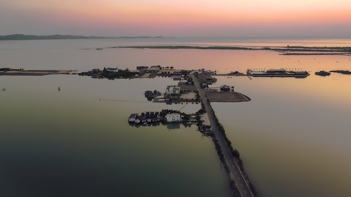
Patok-Fushëkuqe-Ishëm Lagoon
The Patok-Fushëkuqe-Ishëm lagoon, nestled between the Mat River delta and Cape Rodon along the Adriatic coast in Lezhë, spans approximately 5,500.70 ha and holds protected status. Comprising shallow, marshy areas with abundant groundwater, it encompasses the Patok lagoon and the Mat River delta, alongside other significant regions like Droja and the swamps of Godulla and Negli. Desp

National Parks
Cangoj Village
Cangoj village is located in Progër i Devolli, Korçë. The area is about 250.00 ha. It is located exactly 16 km to the northeast of the city of Korça and near the toponym called the gorge of Cangonji, which geographically separates the plain of Korça from the plain of Devolli. The population is about 372 inhabitants, most of whom are engaged in subsistence farming or
National Parks
Kuturman Village
The village of Kuturman is located in the northwest of Librazhd, with an area of 3,600,00 ha. It is crossed by the river Shkumbin and is about 15 km away from the city. According to documented historical data, the village of Kuturmani has an ancient history of archaeological finds, constructions, numerous toponyms with a historical character prove that it has been inhabited
National Parks
Berzane Village
The village of Berzane is located in Zejmen i Mirdita, in Lezhë. The current area is 880.00 ha and 20 km from the city. The village is an area with typical Mediterranean vegetation, the wood and scrub floor is dominated by the duscha with a mixture of heather. Herbaceous vegetation is also of interest, especially medicinal and tanniferous. Large mammals such as: wild boar, wolf, fox, coot, et
National Parks
Levan Village
The village of Levan is located in the southwestern part of Fier, with an area of about 200.00 ha. It is known for its oak forests and 20 km long hills, which start from the lower part of Vjosa in the south and end in Pojan, in the north.It has a rather complicated geological composition, which over time has caused numerous erosion phenomena and the formation of many streams. The large meadows, wh
National Parks
Ballolli Park
Ballolli Park is located in Berat, on both slopes of the mountain ridge of Tërpan, with an area of about 323.3 ha. The park has hilly relief, at heights of 400-900 m. Its territory consists of flysch and limestone, mixed with each other and with tectonic contacts between them.
It was declared a "managed nature reserve" in 2022. Here is also the mountain of Terpan, with a height of 895 m. Its
National Parks
Nature Reserve 'Qafë Bushi'
The "Qafë Bushi" nature reserve is in Elbasan, near Qerret and Sericë villages. Its area is about 500.00 ha. The reserve carries values as a wide area representing the oak forest, its flora and fauna. It was also used as a reserve for hunting: wild boar, rabbit, partridge, etc.
The Nature Reserve 'Qafë Bushi' of the Southeast Albania, has potential values

National Parks
Tej Drini i Bardhë
Tej Drini i Bardhë is located in Has i Kukës, with an area of about 30.00 ha. It is a cross-border mountain area and has the status of protection, for the ecological monitoring of forests.There is also rich biodiversity with flora and fauna, along the Black Drin. It represents an area with values in terms of the spread of two types of forests: oaks and oaks.The former natural forest was
National Parks
Gërmenj-Shelegur Park
Gërmenj-Shelegur Park is located in Kolonje, Korça, with an area of about 430.00 ha. The park has been declared a nature reserve and is a cross-border area of special importance, to ensure the continuity of natural habitats between Albania and Greece. Sheleguri is a rugged and very beautiful mountainous place, southwest of Erseka, on the way to Leskovik. It is the place where the mount

National Parks
Polis Village
The village of Polis is located about 2 km from the national road Elbasan-Librazhd. It is a village in Shushicë municipality, with an area of about 100 km2. The treasures of Polisti are many, but the main one is Egnatia Street. The traces of which can be seen in the two most beautiful bridges of Librazhd as branches of the ancient road: the Kamara bridge and the Guri bridge.Its magical and ri
National Parks
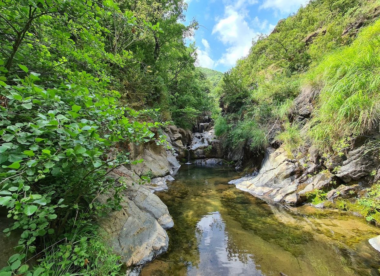
Stavraj
Stavraj Park is located in Librazhd. The current area is 400.00 ha. The area within this natural ecosystem includes forests, heterogeneous agricultural areas and shrubs. The height of the terrain above sea level is 1370 m.It was declared a "managed nature reserve" in 2022 and is divided into two sub-areas:• The Central sub-zone which includes the main forest and bush habitats and is defined a
National Parks
Sopot Village
The village of Sopot is located in Stravaj, in Librazhd. Sopot was declared a protected area in 1996, with an area of about 300.00 ha. You can go there from three directions, Elbasan-Zavalin Sopot, Polis Sopot and the third road Qukës-Stravan, at a distance of about 25 km. The "Star of the Alps" also grows in Sopot and is the only one in the Balkans. Thermal waters flow from the mountain spri
National Parks
Dardhë-Xhyrë Park
The Dardhë-Xhyrë Park, situated amidst the villages of Dardhë and Xhyrë on the Polis mountain in Elbasan, was designated as a managed natural reserve in 2022, covering an expansive area of 400.00 hectares. With Mali i Polis ranging from 1,100 to 1,773 meters above sea level, the park occupies the eastern part of the country, experiencing cold winters with substantial snowfall d
National Parks
Piskal-Shqeri Park
Piskal-Shqeri Park is located near the villages of Rajan and Dërmar, in Kolonje of Korça. It is a protected area of managed resources, with an area of about 5,400,00 ha. The park represents hilly-mountainous territory, where eroded and slippery surfaces dominate. Piskal-Shqeri has 13 named mountains. Piskalit peak is the highest point while the most prominent mountain is Lipec peak 147
National Parks
Dajti Mountain National Park
Dajti Mountain rises to the east of the city of Tirana. It was declared a national park in 1966. It has an area of about 294 km2 and its highest point reaches 1612 m. The park offers historical values of cultural, touristic and natural heritage.
The park has various geological formations, among them we mention Bovilla lake. The park is bordered to the north by Kruja,
50
€/Persons
National Parks
Bjeshka of Orosh, Lezhë
Bjeshka of Orosh is located east of Rrëshen, in Lezhë. Oroshi is also the heart of Mirdita, with an area of 4.745.00 ha. It was declared a protected area of managed resources in 1996.This is a very attractive mountain area with many opportunities for the development of types of mountain tourism. Meadows, springs, steep slopes and alpine pastures are widespread. The most interesting area
