.jpg)
Nature
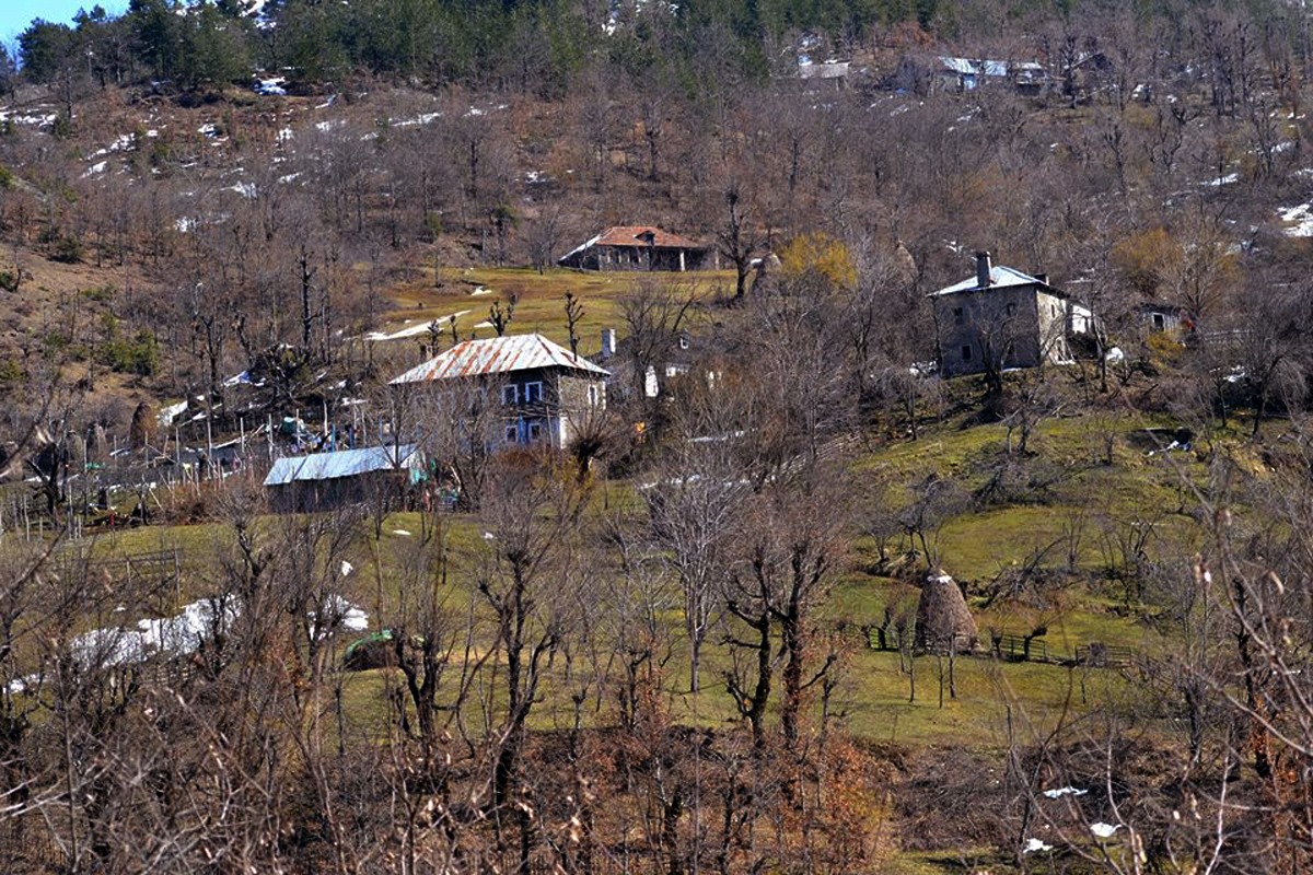
Shkrel Village
Shkreli is situated in the Malësi e Madhe region in the northern part of Albania. Its population of 3,557 residents is bordered to the north by Boga, to the south by Koplik, Reçi, and Lohes, to the east by Dukagjin, and to the west by Bajza e Kastrati.
The historical record of Shkrelia is marked by archaeological findings in the Prroni Thata valley, renowned for the Illyrian Marsheji
Nature
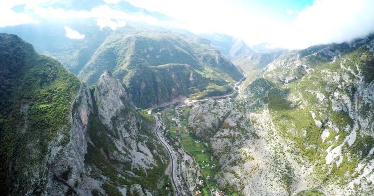
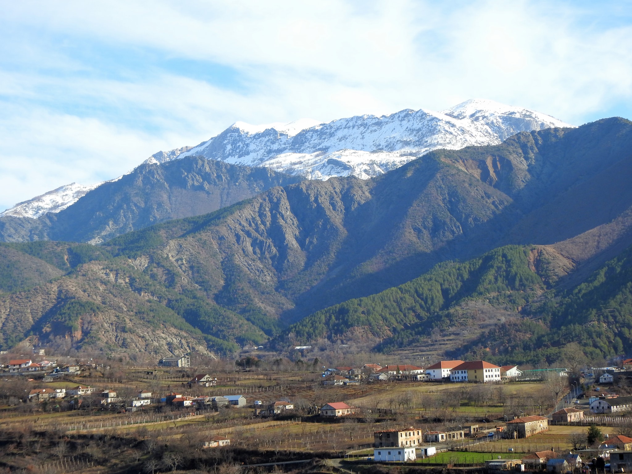
Kelmendi Highlands
The Kelmendi Highlands lie at the northern end of the Albanian Alps, in the Great Highlands. Kelmendi is bordered to the south by Hoti, Kastrati and Shala, to the east by Gashi and Krasniqe and to the north by Vasojevicët, Kuči, Triepši and Gruda.
His name comes from the Latin word clemens-tis, ie: wise, simple, good. Foreign Albanologists, as well as Albanian ones, explain the origi
Nature
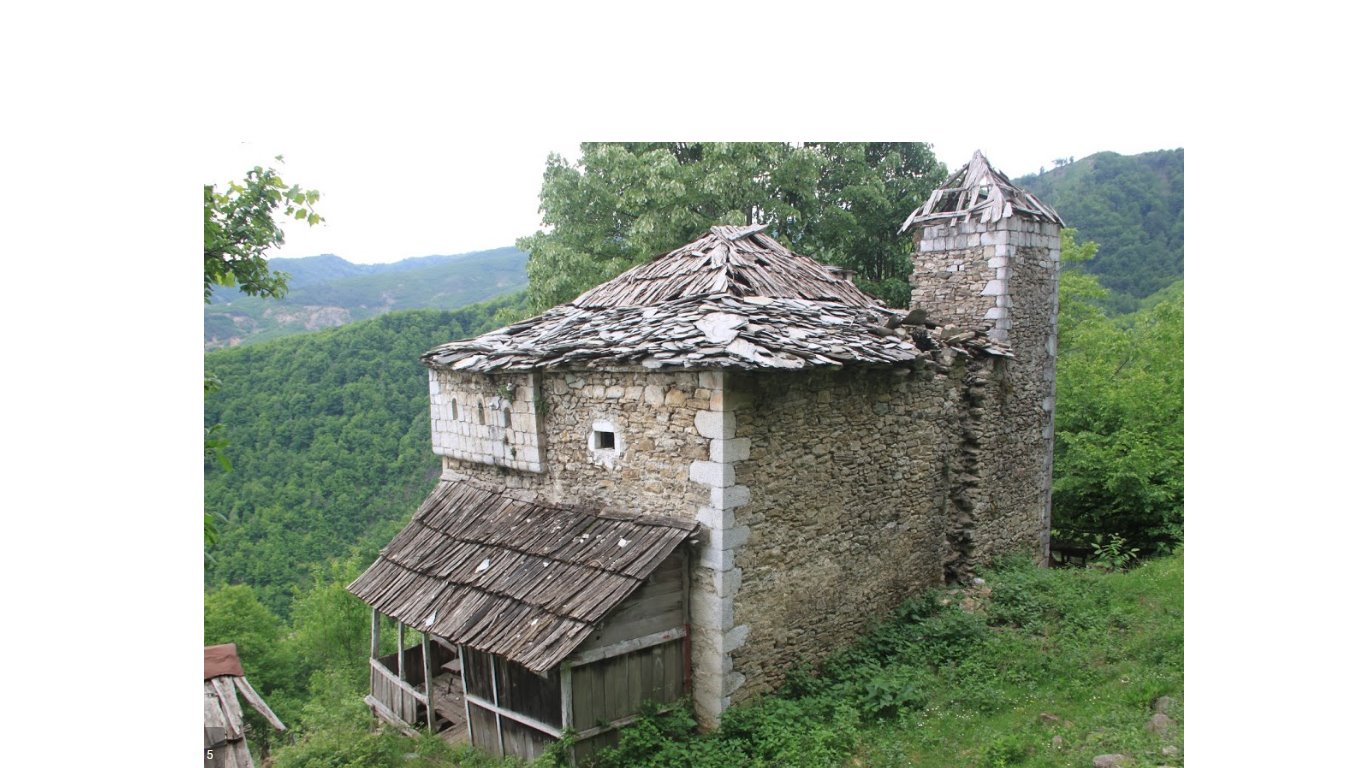
Karakoll Tower Kokdodë, Puka
Karakoll Tower is located in the village with the same name, in Konkodë near Puka. Built in the mid-1800s, it stands out typologically from all the tower-residences in the region. In northern Albania, until a few years ago, three residences were called a tower with a police post. The police post was a one-story structure higher than the residential spaces, with a small perimeter, equipped wit

Nature
"Morenat e Razmës", Malësi e Madhe
"Morenat e Razmës" are a natural area in Albania, located in the villages of Vrith and Razëm, in Shkrel. This place has an altitude of 1,050 meters above sea level.
"Moraine" is usually used to describe a landform that has been created from glacial solids and is usually hill-shaped. In the case of Razma moraines, it seems that they are Quaternary ice deposits from the Gropa o Karikje ci
Nature
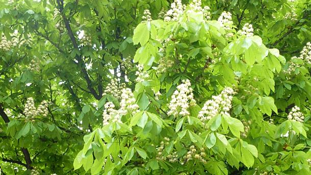
Kokdod Chestnut
Kokdod Chestnut is located near Kokdodë village, in Iballe of Puka. They are at an altitude of 981 m above sea level and constitute a forest of about 10 ha of horse chestnut wood.
The forest has an irregular shape and good development, with an average height of trees over 10-15 m, with a trunk diameter of 100-130 cm and over 100 years old.
Kokdod chestnut carries scientific, didactic, aesth

Nature
Iballe Village, Fushë-Arrëz
Iballa is situated in the northern part of Albania, in Pukë. The village borders on its northern side, with Fierza lake. As one of the most important centers of the Pukë district, Iballa has contributed to the construction of the history of this province.
• The population of Iballa consists of several tribes such as: Thaqi tribe, Berisha tribe, Toplana, etc.
• The field of Ib

Nature
Çerçiz Topulli Monument
The Çerçiz Topulli monument stands proudly in Gjirokastra's main historical square, honoring the revolutionary figure after whom it is named. Born in Gjirokastra in 1880, Çerçiz Topulli is revered as a national hero for his valiant resistance against Ottoman rule in the early 20th century. Notably, he orchestrated the assassination of the Turkish Bimbash, an Ottoman com
Nature
Ali Pasha's Bridge
"Sopot Aqueduct Bridge" over the Bufano stream or as it is otherwise known "Ali Pasha's Bridge" is a Category I Cultural Monument. This bridge is located over the Dunavat neighborhood in Gjirokastër and is an important cultural monument. It is built in the form of a circular arch with a vault thickness of 45 cm. It is 12 km long and through a special architecture with bridges and arches it br
Nature
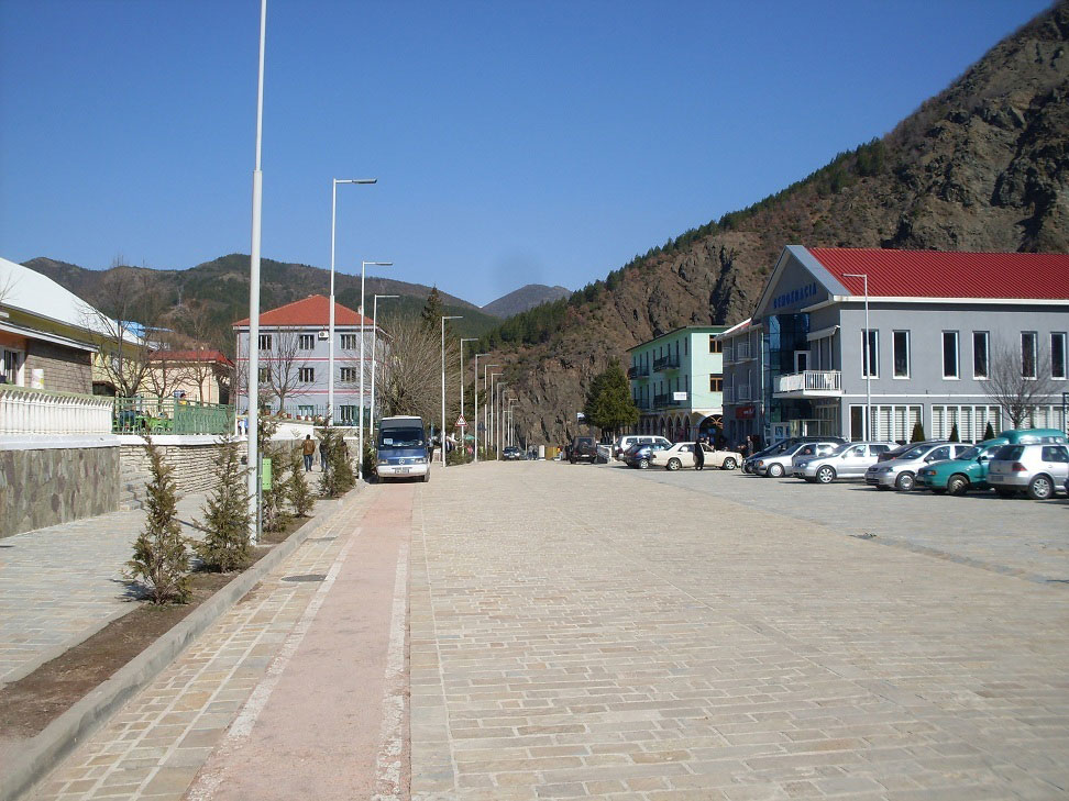
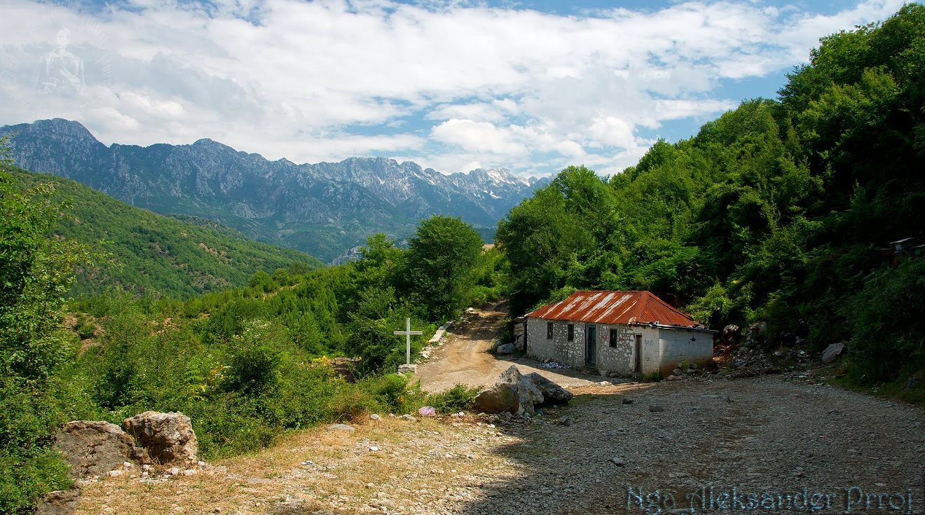
Qafe Mali Village, Puka
The village of Qafë Mali is located in the northeast of Puka district, at an altitude of 955 meters above sea level. This area is of particular importance, as it passes the national road that connects the city of Puka with Tropoja and Kukës. This road stretches from Maja e Mali in the north, near Rroshi mountain with a height of 1937 meters, to the south of the area.The total area of thi
Nature
City of Fushë-Arrëz, Shkodër
Fushë-Arrëz is located in a mountainous area with a significant forest area, part of Northern Albania. The city is bordered to the east by Kukës, to the west by Vau e Deja, to the north by Tropoja and to the south-west by Puka and Mirdita. The total area is over 540.42 km², with a density of 21.55 inhabitants/km² and a population of 11,651 inhabitants.The natural resources
.jpeg)
Nature
Shen Pali Church, Puke
Shen Pali Church is located in the mountain village, Kabash. Shen Pali's Church dates back to the 2nd century AD, and was declared a Cultural Monument on November 5, 1984. The village of Kabash, at that time, was an important center, not only for the area of Puka, but also for the general history of this region.
Although this monument has been left in oblivion, it still preserves the historical a
Nature
Gjegjan Village, Puka
The village of Gjegjan is a village near the city of Puka in Albania. Based on the information provided, this village has a larger population on the area and its residents are of Mirditor origin.
Gjegjani, with a population of about 2,846 inhabitants, constitutes an important community in the city of Puka. Despite the cultural and social differences, the residents of Gjegjani have become one and

Nature
The ruins of the Bishopric of Sapa, Nenshat
The ruins of the Ipeshkvi of Sapa are located at the foot of Mount Saint Mehill above the village of Nënshat, Municipality of Vau-Dejes. The ruins were declared a protected area in July 2016. They are next to the monastery of the Carmelite sisters above the village of Nënshat.As part of the fortification of the city, the Diocese of Sapa with a history of over 950 years was also located i

Nature
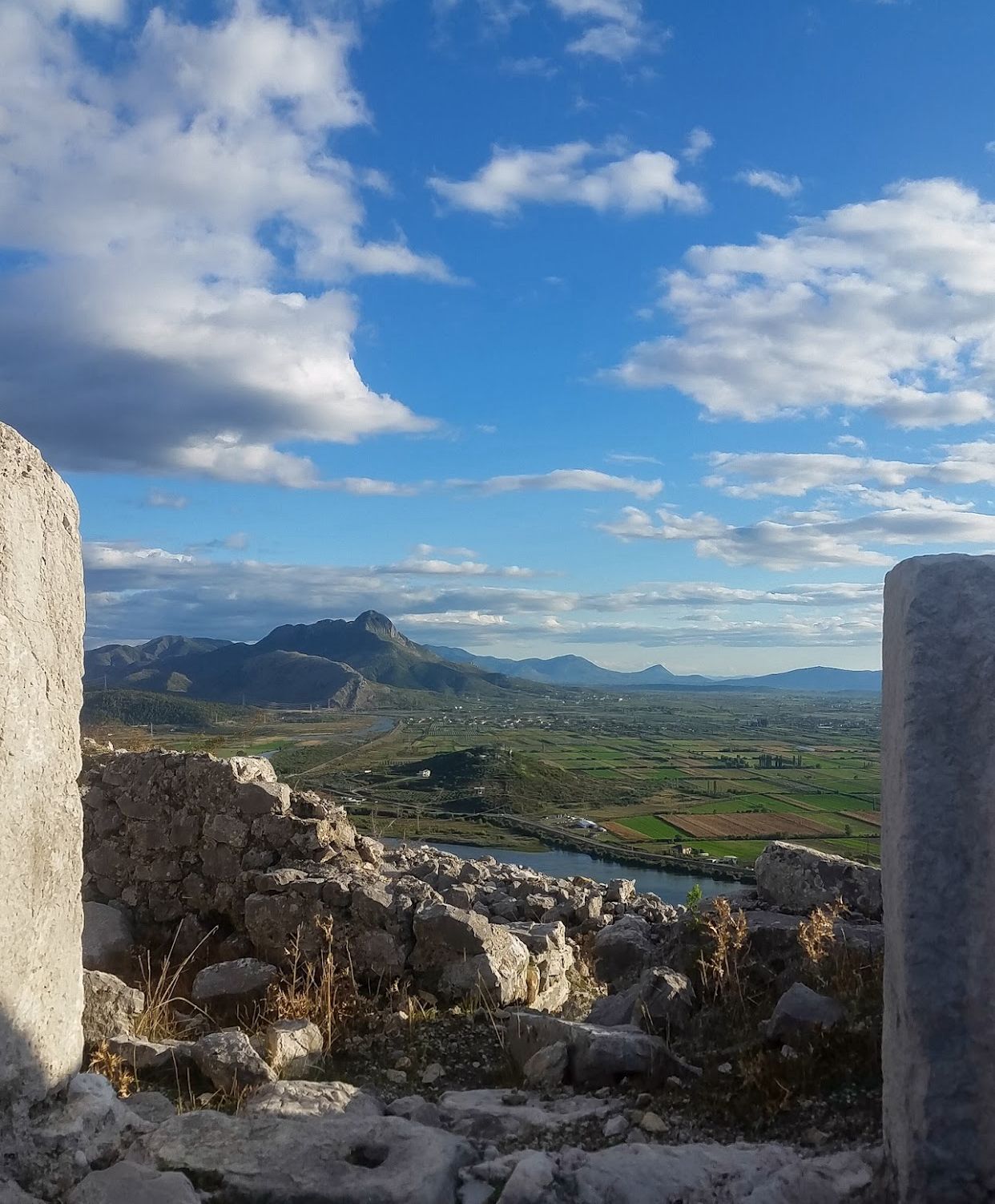
Medieval city of Sarda, Shkodra
Location: The medieval city of Sarda, which is located on a rocky hill on the right bank of the Drin River, 8 km south of the city of Shkodra, has a strategic position in this area. The connection of this hill with the range of hills on the southern bank of the river Drin was an important element in the connection and communication between the city and the three main cultures of the region.
Shurd
Nature
Vau Deja Castle(Danja)
Vau Deja Castle is located on a rocky hill about 120 m above sea level. The castle was declared a Cultural Monument in March 1948 and belongs to the medieval period as part of a fortification system of the Shkodra valley and the Drin valley.It is otherwise known as the castle of Danja, which you mentioned in the documents of the 12th century, which was an episcopal center and one of the most impor
 (1).jpg)
Nature
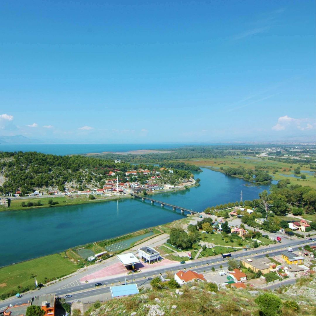
Velipoja village, Shkodra
The coastal village of Velipoje is located 35 km from Shkodra city. Velipoja is a very pleasant tourist center, with a diverse landscape, where the sea, sand, river, hills, forest, lagoon, fields, wetlands are combined.
The tourist area covers an area of 300 ha and is bordered to the north by the Velipoja Managed Reserve, to the south by the Adriatic Sea, to the east by Lezha and to the west by t
.jpg)
Nature
Jezerca Lakes, Shkodër
Jezerce lakes are located on the northern side of the mountain of the same name, Jezerce, with about 20 ha. The glacial cirque of the Jezerca block is located in a small valley, surrounded by high peaks, which starts in Jezerca and ends in Vuthaj and further down in Guci (Black Mountain) where it joins the Vermoshi river.
There are 6 lakes here, where the largest and deepest of them is 'Buni i Je
Nature
Kiri Village, Shkodër
The village of Kiri is located in the administrative unit Pult, Shkodër municipality. The village is on the left side of the river with the same name, in the upper part of the river. This is where the village got its name from. In ancient times, the place was located in Marknonaj, about 1 hour south of the parish seat.

Nature
Guri i Zi Village, Shkodra
Guri i Zi village is located in the municipality of Shkodra. This village has taken its name from a massive rock formation with gigantic dimensions, situated in the center of the village. This rock is very interesting because its composition is unique and differs from the formations of the surrounding mountains, which have limestone compositions.
This magmatic rock has a height of 42 meters above
Nature
Ana e Malit Village, Shkodra
Ana e Mali or Anamali, is a geographical and ethnographic region divided between Albania and Montenegro, respectively between Shkodra and Ulcinj. The total area is over 41.8 km². The various historical events that accompanied the Albanian people in different periods were undoubtedly enriched on the Mountain Side, where the climax reached the separation from the Great Powers of the Albanian te
