Nature
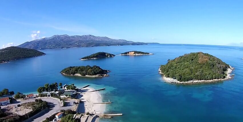
Ksamil Islands
Ksamil Islands or Tetranis Islands are four small islands located 8 km south of Saranda. Ksamil Islands are the most attractive part of this coastal area.The combined area of the four islands of Ksamil is 7.1 ha and they are part of Butrint National Park.
The islands can be reached by boat. All four islands are named after the village where they are located, Ksamil, which is located in the
Nature
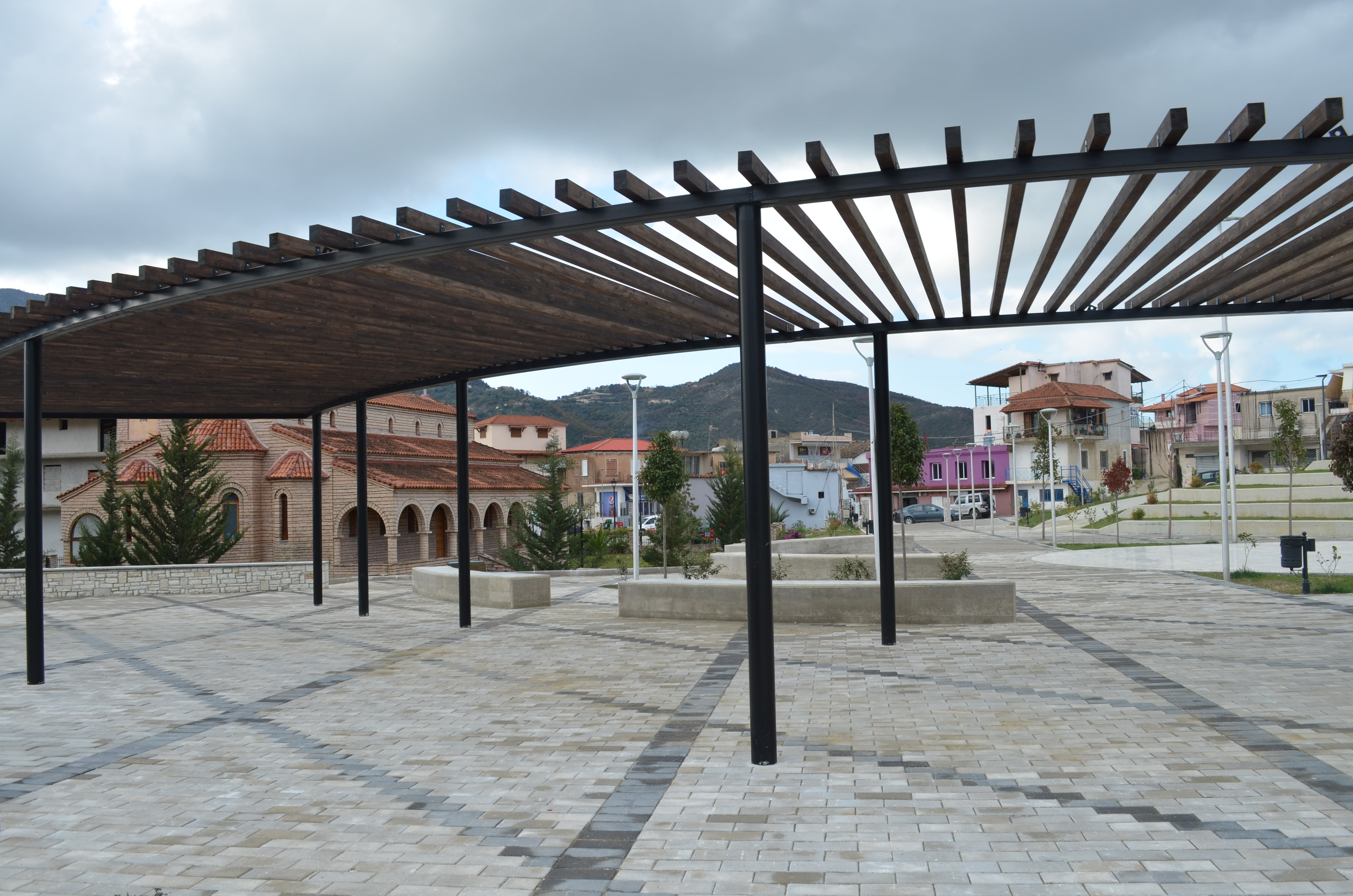
Finiq City
The city of Finiq is located 7 km from the city of Delvina, 8 km from the shores of the Ionian Sea and 20 km from the city of Saranda. The total area is 44,100 ha and the population reaches 35,518. Finiqi borders Delvina to the north, Dropulli to the east, Greece to the south and Saranda to the west.
The city has an ancient history, as the capital of the Kaons, while in the 3rd century it b
Nature
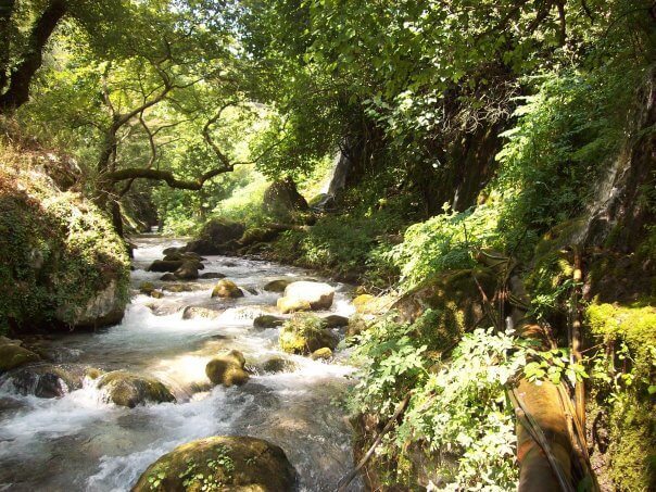
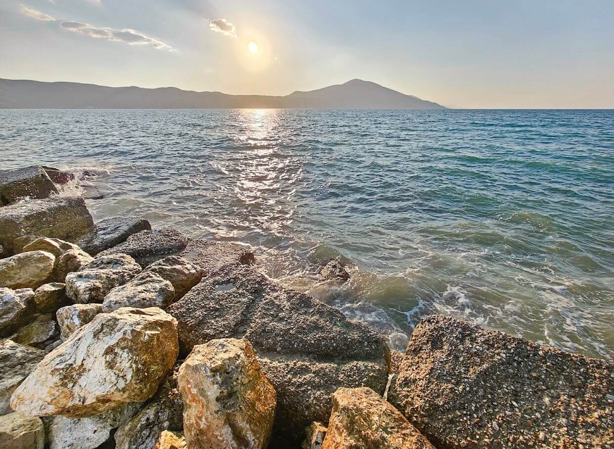
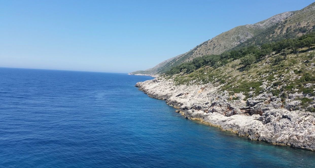
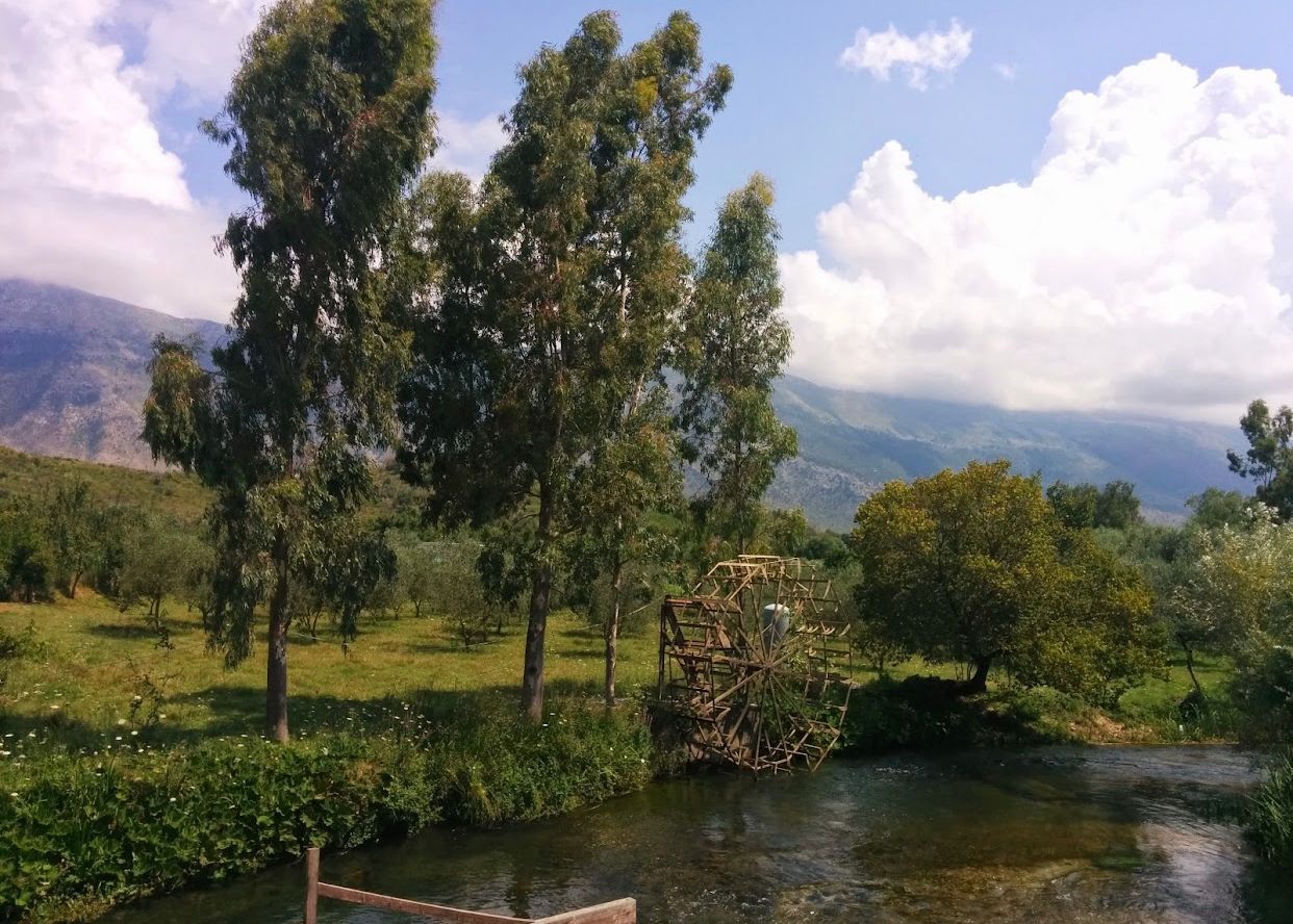
Kalasa River
The Kalasa River originates in the south of the Galishti mountain and follows the direction from the southeast. Under Tatzat, it collects large karst sources and after receiving the waters of the Delvina and Gajdar streams, it crosses the Vurgu plain.
The Kalasa River is the largest tributary of Bistrica in the northeast of Saranda. It has a length of about 34 km, an average height of 531 m and a
.jpg)
Nature
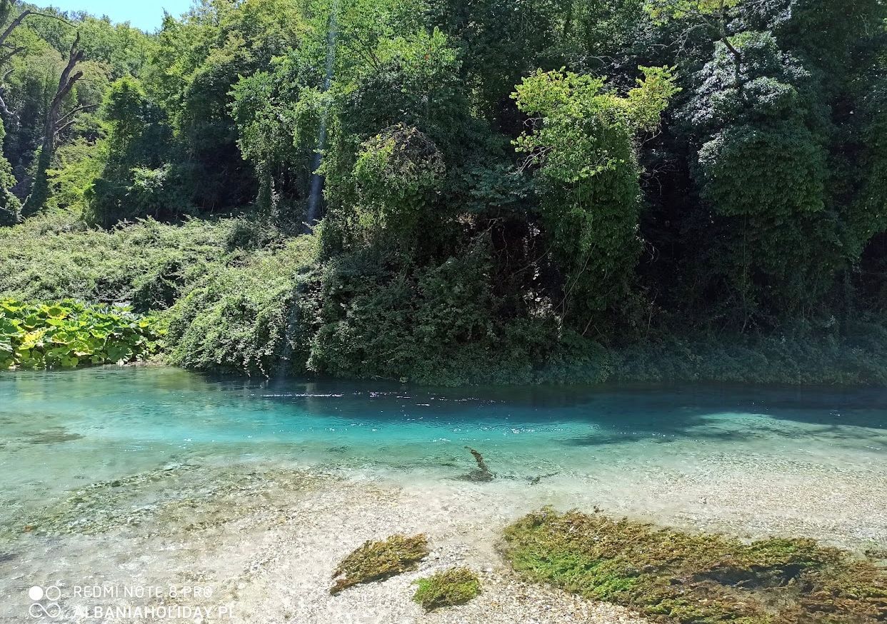
Pavlla River
The Pavlla River originates near the village of Pavlla in Çamëria, in the southernmost part of Albania. The river flows in a sheltered bed through the plains of Mursia and Vrina, passes south of Lake Butrint and flows into the Ionian Sea, in the Gulf of Butrint.
The river is 50 km long, with an average height of 521 m and a catchment area of 374 km². The Karroqi stream is also th
Nature
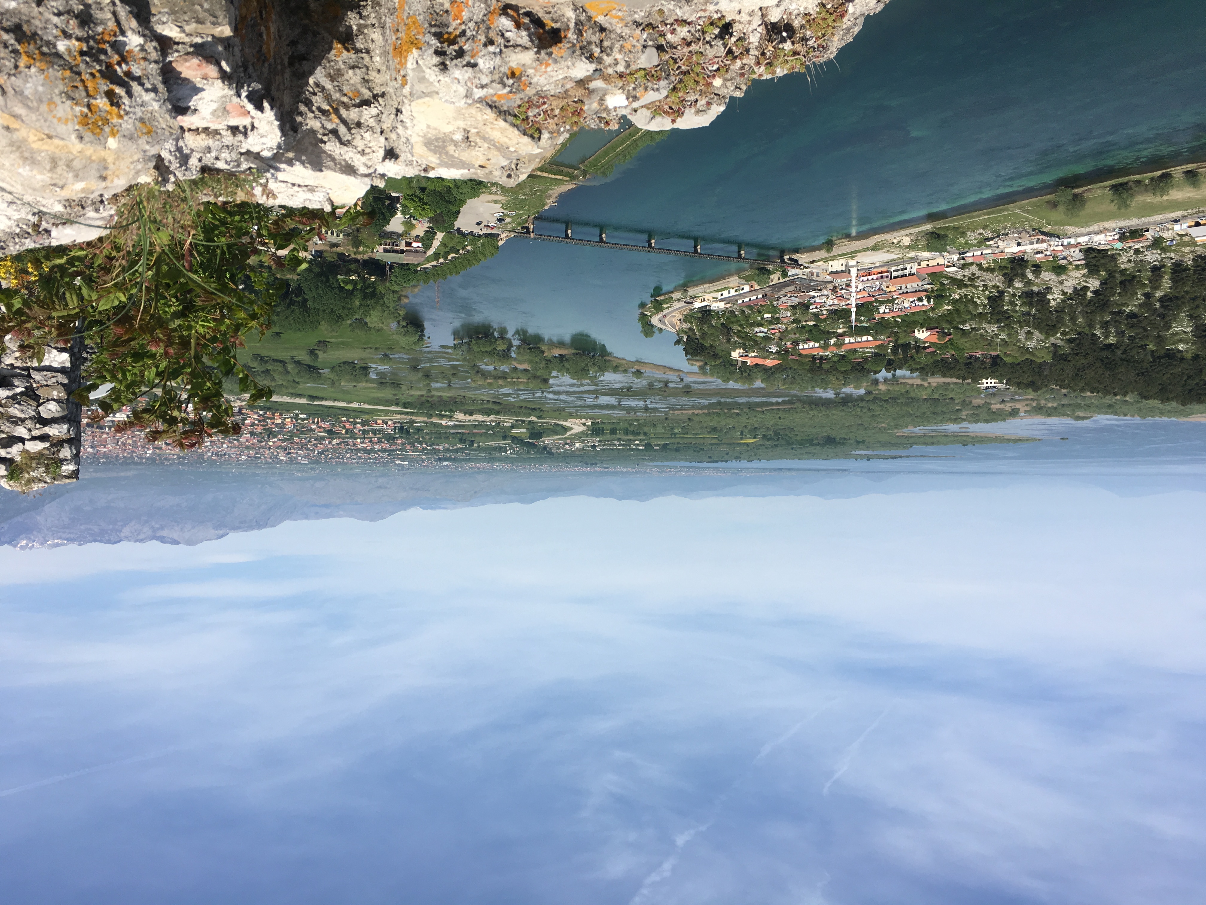
Bistrica River
Bistrica River originates from the Gjerë mountain and takes its direction in the southwest of Albania. Bistrica is the only river in Albania that does not flow into the Adriatic Sea, but into the Ionian Sea. The name Bistrica comes from the Slavic language bistro, clear.
The Bistrica River initially emptied into Butrint Lake, connected by the Vivar Canal to the Ionian Sea. Bistrica is

Nature
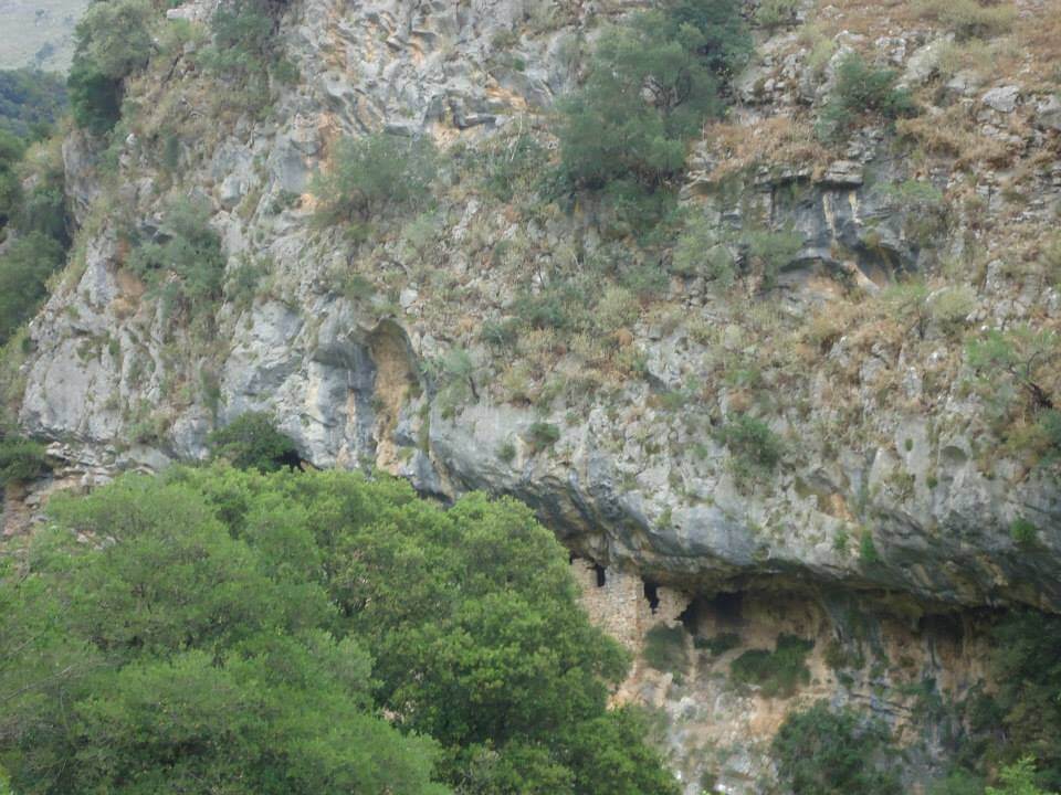
Nivica Canyons
Nivicë canyons are located near the village of Nivicë, in the south of Albania. The canyons were formed by the erosion of the Nivica stream, part of the Benca river, in carbonate rocks. It is several km long, 15 m wide and up to 700 m deep.
The stream of Nivica has formed a gorge with a very narrow bed, about 3 km long, it continues with the basin in Merje and joins the Gurrë e Pro

Nature
Leshnica Bridge
Leshnica Bridge is located in Dhivër, Saranda.
The bridge has undergone restoration which consists of its maintenance, consolidation and cleaning. Also, the works were carried out in the masonry by filling the joints, placing gabions, for the protection of the shoulders of the bridge from the current of the river, as well as the restoration of the cobblestones of the bridge.
Nature
Buna River
The Buna River, originating from Lake Shkodra, winds its way for 44 kilometers before meeting the Adriatic Sea, serving as the natural border between Albania and Montenegro. Along its picturesque journey, it showcases a rich tapestry of flora and fauna, with lush fields and forests lining its banks.
The river's delta, with Ada Island at its center, is a haven for migratory birds and supports dive
Nature
Tatzat Cave
Tatzat Cave is located near Tatzat village. The cave is formed in upper Cretaceous limestone rocks. It is about 150 m long, 5 m wide and 10 m high. It is filled with numerous stalactite and stalagmite concretions of rare beauty.
Tatzati cave has scientific (geological, geomorphological, hydrological, biological), cultural, didactic and touristic values.
Nature
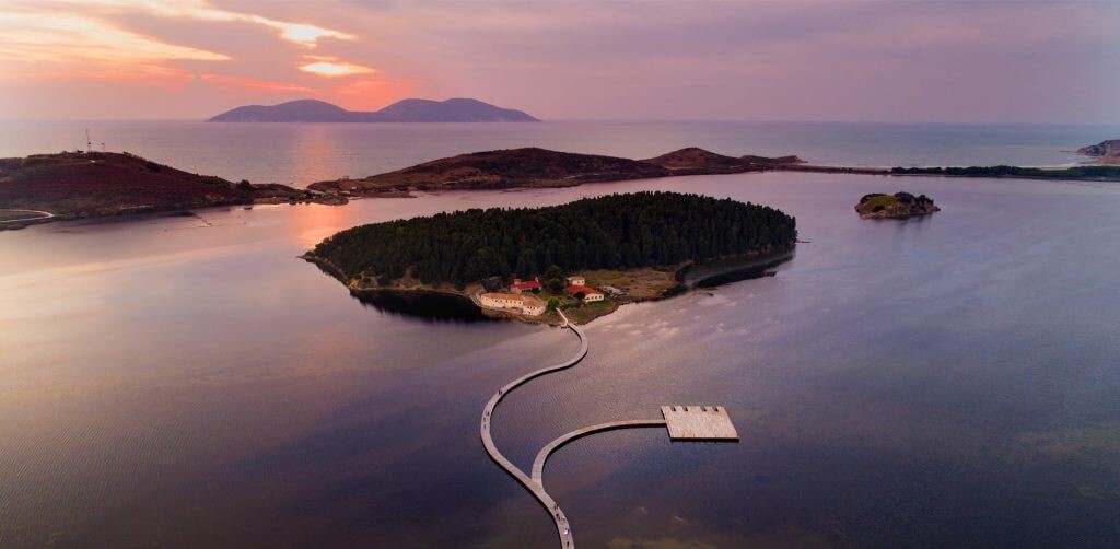
Narta Lagoon
Narta Lagoon is located in the southeastern part of Vlore Bay. It was formed by the continuous accumulation of solid streams of the Vjosa River.It is surrounded by the hills of Zvernec and to the south is Narta. The water salinity is high, ranging from 28 per mil in winter to 75 per mil in summer. The total area of the lagoon is about 42 km², of which 14 km² mainly in the north is
Nature
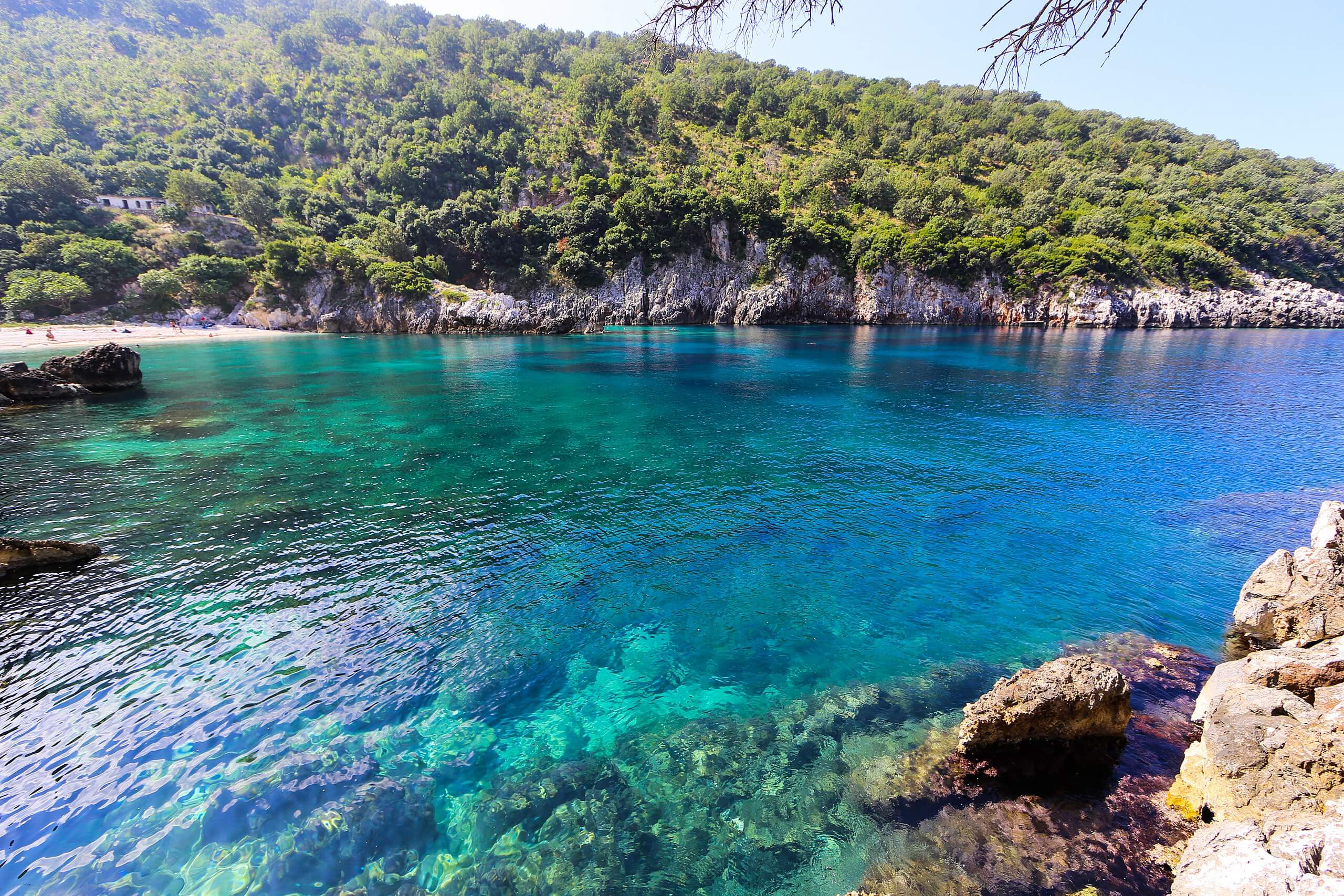
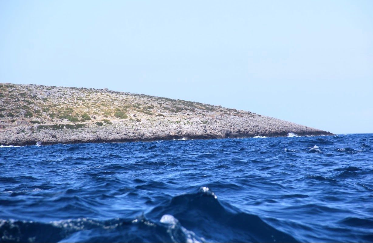
Brisan Bay, Karaburun
Brisan Bay is located on the Karaburun peninsula on the island of Vlore. Brisan Bay, also known as Bear Bay, is a natural wonder. Picturesque landscapes, seaside rocks, typical white sandy beaches and water so clear you can see everything beyond are just some of the special features.
This small bay is still one of Karaburun's loneliest beaches, so it is only visited by vacationers who

Nature
Vlora Bay
Vlora Bay begins at Cape Triport and ends at Cape Gjuheza, with the Southern Islands in between. The bay is 19 km long and 16 km wide. To the south is the Dukat Field, which is clearly delimited by the Pashaliman Lagoon by mountains, the sea, and the sea to the west.
The area of Myzeqe, as well as the Vlora river valley (Shushica), both are quite suitable for agriculture. While the flat part
Nature
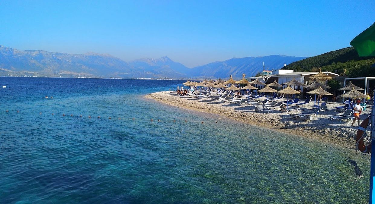
Orikum Beach , Vlora
Orikum Beach is located south of Vlore Bay, just a 5 km drive. In the background you can see Mount Athanasius, 2,000 m above sea level in Vlore, and the view is breathtaking.
The beach is very beautiful, unlike the rest of the area here, the coastline is sandy, with crystal clear water and a soft, gentle shore. This beach is suitable for families with children, where you can walk in the shallow w
Nature
Cape of Gjuheza, Vlora
Cape Gjuhëza is located at the northwest end of Karaburun, the westernmost point of Albania. The cape is 1.1 km (0.68 mi) into the sea in the shape of a tongue, hence its name.
The heights of the cape gradually descend towards the water, while the southern shores form 30 to 40 m high steep cliffs that drop directly into the Ionian Sea. The cape lacks vegetation, while limestone cliffs, heavi
Nature
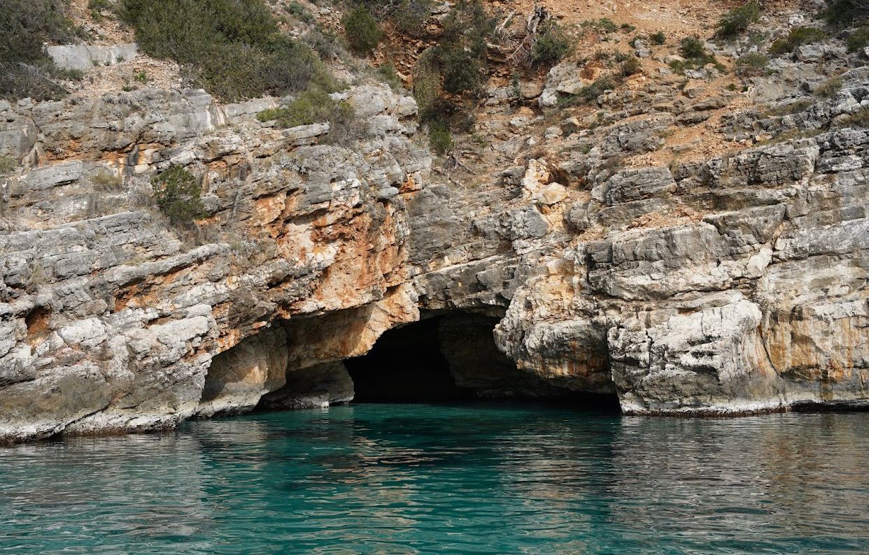
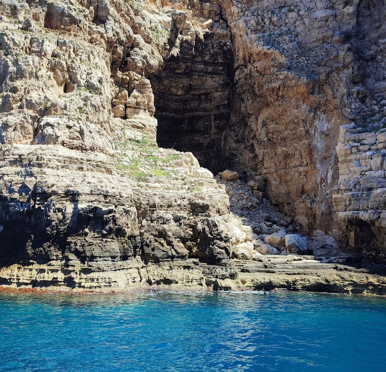
Dafina Cave, Karaburun
Dafina Cave is located on the Karaburun Peninsula, Vlora. This cave has created a truly unique beach in its interior. The view offered by this cave is so intriguing and beautiful at the same time.
To be part of the discovery of this cave on a hot summer day, to dive and swim in the crystal waters, remains an attraction full of impressions for all those foreign and local tourists, without worrying
Nature
Devil's Mouth Coral Barrier, Vlora
The Devil's Mouth coral barrier is located southwest of Sazan Island, between it and Karaburun. It contains a characteristic habitat with corals, so it is a natural monument that is still preserved in good condition. It is known for its scientific, didactic and touristic values. It is a coral habitat with a depth of about 10 m.
The Devil's Mouth coral barrier remains one of the attractions that m
Nature
Saint Andrew's Bay, Karaburun
Saint Andrew Bay is located in Karaburun, Vlora. The coast is of fine white sand, with blue and crystal clear water make the beach a natural miracle.
This small bay is isolated by the slopes that hug the beach. This makes the stay even more attractive for tourists who want to enjoy total relaxation, only in the company of the sun and the sea. This bay has a view that amazes you!

Nature
Dukat Village, Vlora
The village of Dukat is located south of Pashaliman Bay, in Vlora. Dukat is bordered to the northeast by Tragjas, to the east by Tërbač, to the south by Palasa, and to the west by the Adriatic and Ionian seas. This picturesque village is located at the foot of the Paliske and Qore mountains, in a deep and broken gorge, with numerous streams. It remains an impregnable natural fortress for cen
Nature
Tragjas Village, Vlora
Tragjas is located 20 kilometers south of Vlora at the foot of the Lungara mountain, which borders it from the north-west to the south-east. Traces of the old settlement have been discovered on the hill known as Qyteza e Sofa, and some Illyrian mounds have also been discovered. In antiquity, this village, also known as Tregas, Dragjat, and Tregasaj, was part of the fortified centers of the bay of
Nature
Radhima Beach, Vlora
Beach clubs with limited access occupy a substantial portion of the beach. Only visitors to the tourism area have access to beach facilities. Deckchairs and umbrellas are available, as well as a beach café, changing rooms, showers, and toilets. This beach line is also overseen by a lifeguard during the season. This beach is placed fairly close to the road and is easily accessible; parking i
